Szelevény geodata
Szelevény (Jász-Nagykun-Szolnok) is a populated place; located in Hungary in Europe/Budapest (GMT+2) time zone. With population of 1,137 people, there are 867 cities with bigger population in this country. Compared to other cities in Hungary, 76.7% of cities are located further ↑North; 66.2% of cities are located further ←West and 98.3% of cities have higher elevation than Szelevény. Note1


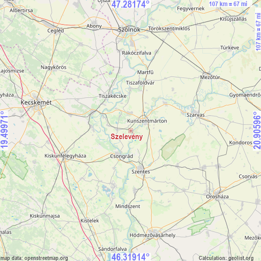
Szelevény GPS coordinates[2]
46° 48' 9.324" North, 20° 12' 10.188" East
| Map corner | latitude | longitude |
|---|---|---|
| Upper-left | 47.28174°, | 19.49971° |
| Center: | 46.80259°, | 20.20283° |
| Lower-right: | 46.31914°, | 20.90596° |
| Map W x H: | 107×107 km | = 66.5×66.5mi |
| max Lat: | 48.46667° ⇑76.7% North |
| Szelevény: | 46.80259° |
| min Lat: | ⇓23.3% South 45.79108° |
| min Long | Szelevény | max Long |
| 16.27358° | 20.20283° | 22.68096° |
| W 66.2%⇐ | ⇒33.8% E |
Elevation
Elevation of Szelevény is 81 m = 266 ft, and this is 48.7 m = 160 ft below average elevation for this country.
| Max E: |
444 m = 1457 ft | 98.3% |
| Avg. | 129.7 m = 426 ft | |
| Szelevény | 81 m = 266 ft | |
Min E: |
71 m = 233 ft | 1.7% |
See also: Hungary elevation on elevation.city.
Geographical zone
Szelevény is located in North temperate zone (between Tropic of Cancer and the Arctic Circle). Distance of this North polar circle is 2197.2 km =1365.3 mi to North.| Distance of | km | miles | from Szelevény |
|---|---|---|---|
| North Pole | 4803.1 | 2984.5 | to North |
| Arctic Circle | 2197.2 | 1365.3 | to North |
| Tropic Cancer | 2598 | 1614.3 | to South |
| Equator | 5204 | 3233.6 | to South |


Nearby cities:
15 places around Szelevény: (largest is in red/bold)
• Békésszentandrás
22.5 km =14 mi,  71°
71°
• Cibakháza
17.5 km =10.9 mi,  358°
358°
• Csanytelek
23.9 km =14.9 mi,  194°
194°
• Cserkeszőlő
6.8 km =4.2 mi,  349°
349°
• Csongrád
10.9 km =6.8 mi,  204°
204°
• Fábiánsebestyén
24.1 km =15 mi,  123°
123°
• Kunszentmárton
7.7 km =4.8 mi,  58°
58°
• Lakitelek
17.8 km =11.1 mi,  297°
297°
• Szegvár
24 km =14.9 mi,  176°
176°
• Szentes
16.6 km =10.3 mi,  164°
164°
• Tiszaalpár
15.6 km =9.7 mi,  274°
274°
• Tiszaföldvár
20.4 km =12.7 mi,  10°
10°
• Tiszakécske
16.3 km =10.1 mi,  332°
332°
• Tömörkény
23.9 km =14.9 mi,  210°
210°
• Öcsöd
18.5 km =11.5 mi,  54°
54°
Sources, notices
• [Note1] Compared only with cities in Hungary existing in our database
• [Src1] Map data: © OpenStreetMap contributors (CC-BY-SA)
• [Src2] Other city data from geonames.org with taken over terms of usage.
• [Src3] Geographical zone / Annual Mean Temperature by Robert A. Rohde @ Wikipedia
