Kismaros geodata
Kismaros (Pest) is a populated place; located in Hungary in Europe/Budapest (GMT+2) time zone. With population of 1,911 people, there are 820 cities with bigger population in this country. Compared to other cities in Hungary, 80% of cities are located further ↓South; 64% of cities are located further →East and 66.2% of cities have lower elevation than Kismaros. Note1


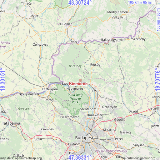
Kismaros GPS coordinates[2]
47° 50' 14.712" North, 19° 0' 16.668" East
| Map corner | latitude | longitude |
|---|---|---|
| Upper-left | 48.30724°, | 18.30151° |
| Center: | 47.83742°, | 19.00463° |
| Lower-right: | 47.36331°, | 19.70776° |
| Map W x H: | 105×105 km | = 65.2×65.2mi |
| max Lat: | 48.46667° ⇑20% North |
| Kismaros: | 47.83742° |
| min Lat: | ⇓80% South 45.79108° |
| min Long | Kismaros | max Long |
| 16.27358° | 19.00463° | 22.68096° |
| W 36%⇐ | ⇒64% E |
Elevation
Elevation of Kismaros is 132 m = 433 ft, and this is 2.3 m = 8 ft above average elevation for this country.
| Max E: |
444 m = 1457 ft | 33.8% |
| Kismaros | 132 m 433 ft | |
| Avg. | 129.7 m = 426 ft | |
Min E: |
71 m = 233 ft | 66.2% |
See also: Hungary elevation on elevation.city.
Geographical zone
Kismaros is located in North temperate zone (between Tropic of Cancer and the Arctic Circle). Distance of this North polar circle is 2082.2 km =1293.8 mi to North.| Distance of | km | miles | from Kismaros |
|---|---|---|---|
| North Pole | 4688 | 2913 | to North |
| Arctic Circle | 2082.2 | 1293.8 | to North |
| Tropic Cancer | 2713.1 | 1685.8 | to South |
| Equator | 5319 | 3305.1 | to South |


Nearby cities:
15 places around Kismaros: (largest is in red/bold)
• Diósjenő
11.7 km =7.3 mi,  14°
14°
• Dunabogdány
5.9 km =3.7 mi,  152°
152°
• Kosd
13.4 km =8.3 mi,  104°
104°
• Leányfalu
14.6 km =9.1 mi,  155°
155°
• Nagymaros
6 km =3.7 mi,  213°
213°
• Pilismarót
11.3 km =7 mi,  238°
238°
• Rétság
14.1 km =8.8 mi,  44°
44°
• Szob
10.2 km =6.3 mi,  258°
258°
• Sződ
17.6 km =10.9 mi,  135°
135°
• Sződliget
15.8 km =9.8 mi, 137°
• Tahitótfalu
12.1 km =7.5 mi, 143°
• Tolmács
12.9 km =8 mi, 37°
• Verőce
2.7 km =1.7 mi,  122°
122°
• Visegrád
6.3 km =3.9 mi,  203°
203°
• Vác
12 km =7.5 mi, 124°
Sources, notices
• [Note1] Compared only with cities in Hungary existing in our database
• [Src1] Map data: © OpenStreetMap contributors (CC-BY-SA)
• [Src2] Other city data from geonames.org with taken over terms of usage.
• [Src3] Geographical zone / Annual Mean Temperature by Robert A. Rohde @ Wikipedia
