Ópusztaszer geodata
Ópusztaszer (Csongrád) is a populated place; located in Hungary in Europe/Budapest (GMT+2) time zone. With population of 2,260 people, there are 687 cities with bigger population in this country. Compared to other cities in Hungary, 86.5% of cities are located further ↑North; 63.8% of cities are located further ←West and 98.3% of cities have higher elevation than Ópusztaszer. Note1


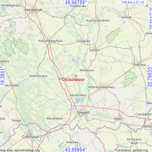
Ópusztaszer GPS coordinates[2]
46° 29' 9.312" North, 20° 5' 13.992" East
| Map corner | latitude | longitude |
|---|---|---|
| Upper-left | 46.96789°, | 19.3841° |
| Center: | 46.48592°, | 20.08722° |
| Lower-right: | 45.99964°, | 20.79035° |
| Map W x H: | 107.7×107.7 km | = 66.9×66.9mi |
| max Lat: | 48.46667° ⇑86.5% North |
| Ópusztaszer: | 46.48592° |
| min Lat: | ⇓13.5% South 45.79108° |
| min Long | Ópusztaszer | max Long |
| 16.27358° | 20.08722° | 22.68096° |
| W 63.8%⇐ | ⇒36.2% E |
Elevation
Elevation of Ópusztaszer is 81 m = 266 ft, and this is 48.7 m = 160 ft below average elevation for this country.
| Max E: |
444 m = 1457 ft | 98.3% |
| Avg. | 129.7 m = 426 ft | |
| Ópusztaszer | 81 m = 266 ft | |
Min E: |
71 m = 233 ft | 1.7% |
See also: Hungary elevation on elevation.city.
Geographical zone
Ópusztaszer is located in North temperate zone (between Tropic of Cancer and the Arctic Circle). Distance of this North polar circle is 2232.4 km =1387.1 mi to North.| Distance of | km | miles | from Ópusztaszer |
|---|---|---|---|
| North Pole | 4838.3 | 3006.4 | to North |
| Arctic Circle | 2232.4 | 1387.1 | to North |
| Tropic Cancer | 2562.8 | 1592.4 | to South |
| Equator | 5168.7 | 3211.7 | to South |


Nearby cities:
15 places around Ópusztaszer: (largest is in red/bold)
• Algyő
19.2 km =11.9 mi,  151°
151°
• Baks
6.4 km =4 mi,  10°
10°
• Balástya
9.3 km =5.8 mi,  220°
220°
• Csanytelek
12.4 km =7.7 mi, 12°
• Csengele
18.2 km =11.3 mi,  290°
290°
• Forráskút
19.1 km =11.9 mi,  225°
225°
• Kistelek
8.4 km =5.2 mi,  259°
259°
• Mindszent
8.9 km =5.5 mi,  62°
62°
• Pusztaszer
10.5 km =6.5 mi,  313°
313°
• Pálmonostora
18.5 km =11.5 mi,  325°
325°
• Szatymaz
16.3 km =10.1 mi,  192°
192°
• Szegvár
15.4 km =9.6 mi,  42°
42°
• Sándorfalva
13.9 km =8.6 mi,  176°
176°
• Tömörkény
15 km =9.3 mi,  347°
347°
• Zsombó
19.8 km =12.3 mi,  205°
205°
Sources, notices
• [Note1] Compared only with cities in Hungary existing in our database
• [Src1] Map data: © OpenStreetMap contributors (CC-BY-SA)
• [Src2] Other city data from geonames.org with taken over terms of usage.
• [Src3] Geographical zone / Annual Mean Temperature by Robert A. Rohde @ Wikipedia
