Pekan Bahapal geodata
Pekan Bahapal (North Sumatra) is a populated place; located in Indonesia in Asia/Jakarta (GMT+7) time zone. With population of 40,000 people, there are 270 cities with bigger population in this country. Compared to other cities in Indonesia, 98.1% of cities are located further ↓South; 97.7% of cities are located further →East and 55.6% of cities have lower elevation than Pekan Bahapal. Note1


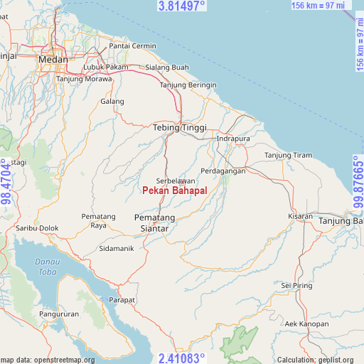
Pekan Bahapal GPS coordinates[2]
3° 6' 47.268" North, 99° 10' 24.672" East
| Map corner | latitude | longitude |
|---|---|---|
| Upper-left | 3.81497°, | 98.4704° |
| Center: | 3.11313°, | 99.17352° |
| Lower-right: | 2.41083°, | 99.87665° |
| Map W x H: | 156.1×156.1 km | = 97×97mi |
| max Lat: | 5.88969° ⇑1.9% North |
| Pekan Bahapal: | 3.11313° |
| min Lat: | ⇓98.1% South -10.934° |
| min Long | Pekan Bahapal | max Long |
| 95.1345° | 99.17352° | 140.9419° |
| W 2.3%⇐ | ⇒97.7% E |
Elevation
Elevation of Pekan Bahapal is 128 m = 420 ft, and this is 101.7 m = 334 ft below average elevation for this country.
| Max E: |
3185 m = 10449 ft | 44.4% |
| Avg. | 229.7 m = 754 ft | |
| Pekan Bahapal | 128 m = 420 ft | |
Min E: |
-1 m = -3 ft | 55.6% |
See also: Pekan Bahapal elevation on elevation.city.
Geographical zone
Pekan Bahapal is located in North Torrid zone (between Equator and Tropic of Cancer). Distance of Equator is 346.1 km =215.1 mi to South.| Distance of | km | miles | from Pekan Bahapal |
|---|---|---|---|
| North Pole | 9660.9 | 6003 | to North |
| Arctic Circle | 7055 | 4383.8 | to North |
| Tropic Cancer | 2259.8 | 1404.2 | to North |
| Equator | 346.1 | 215.1 | to South |


Nearby cities:
15 places around Pekan Bahapal: (largest is in red/bold)
• Kisaran
51.1 km =31.8 mi,  106°
106°
• Limapuluh
27.8 km =17.3 mi,  77°
77°
• Lubuk Pakam
59.8 km =37.2 mi,  326°
326°
• Pane Tongah
32.1 km =19.9 mi,  224°
224°
• Parapat
56.6 km =35.2 mi,  207°
207°
• Pematang Raya
39.8 km =24.7 mi,  245°
245°
• Pematangsiantar
20.7 km =12.9 mi, 214°
• Perbaungan
56 km =34.8 mi, 334°
• Sarimatondang
39.8 km =24.7 mi,  225°
225°
• Sei Rampah
41.5 km =25.8 mi,  354°
354°
• Sipintuangin
54 km =33.6 mi, 231°
• Sondi
37.9 km =23.5 mi, 245°
• Tebingtinggi
24 km =14.9 mi,  357°
357°
• Tigarunggu
55.6 km =34.5 mi,  244°
244°
• Tuktuk Sonak
60.6 km =37.7 mi, 215°
Sources, notices
• [Note1] Compared only with cities in Indonesia existing in our database
• [Src1] Map data: © OpenStreetMap contributors (CC-BY-SA)
• [Src2] Other city data from geonames.org with taken over terms of usage.
• [Src3] Geographical zone / Annual Mean Temperature by Robert A. Rohde @ Wikipedia
