Tanjung Palas geodata
Tanjung Palas (North Kalimantan) is a seat of a third-order administrative division; located in Indonesia in Asia/Makassar (GMT+8) time zone. In our database, there are 407 cities with bigger population. Compared to other cities in Indonesia, 97.8% of cities are located further ↓South; 78.8% of cities are located further ←West and 89% of cities have higher elevation than Tanjung Palas. Note1


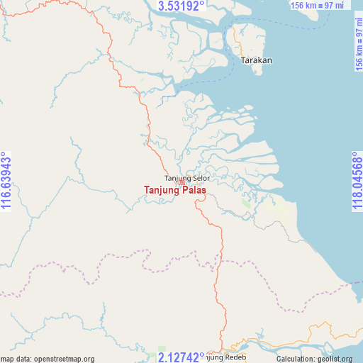
Tanjung Palas GPS coordinates[2]
2° 49' 47.568" North, 117° 20' 33.18" East
| Map corner | latitude | longitude |
|---|---|---|
| Upper-left | 3.53192°, | 116.63943° |
| Center: | 2.82988°, | 117.34255° |
| Lower-right: | 2.12742°, | 118.04568° |
| Map W x H: | 156.2×156.2 km | = 97.1×97.1mi |
| max Lat: | 5.88969° ⇑2.2% North |
| Tanjung Palas: | 2.82988° |
| min Lat: | ⇓97.8% South -10.934° |
| min Long | Tanjung Palas | max Long |
| 95.1345° | 117.34255° | 140.9419° |
| W 78.8%⇐ | ⇒21.2% E |
Elevation
Elevation of Tanjung Palas is 11 m = 36 ft, and this is 218.7 m = 718 ft below average elevation for this country.
| Max E: |
3185 m = 10449 ft | 89% |
| Avg. | 229.7 m = 754 ft | |
| Tanjung Palas | 11 m = 36 ft | |
Min E: |
-1 m = -3 ft | 11% |
See also: Indonesia elevation on elevation.city.
Geographical zone
Tanjung Palas is located in North Torrid zone (between Equator and Tropic of Cancer). Distance of Equator is 314.7 km =195.5 mi to South.| Distance of | km | miles | from Tanjung Palas |
|---|---|---|---|
| North Pole | 9692.4 | 6022.6 | to North |
| Arctic Circle | 7086.5 | 4403.3 | to North |
| Tropic Cancer | 2291.3 | 1423.7 | to North |
| Equator | 314.7 | 195.5 | to South |


Nearby cities:
15 places around Tanjung Palas: (largest is in red/bold)
• Atap
118.9 km =73.9 mi,  343°
343°
• Kerangagung
23.6 km =14.7 mi,  323°
323°
• Long Bang
48.7 km =30.3 mi,  272°
272°
• Long Beluah
29.2 km =18.1 mi,  254°
254°
• Long Loreh
103.9 km =64.6 mi,  291°
291°
• Long Peso
63.8 km =39.6 mi,  255°
255°
• Malinau
116.1 km =72.1 mi, 316°
• Mensalong
122.7 km =76.2 mi,  327°
327°
• Salinbatu
12.3 km =7.6 mi,  0°
0°
• Sebuku
134.8 km =83.8 mi,  345°
345°
• Sekatak Bengara
32 km =19.9 mi, 333°
• Sesayap
91.9 km =57.1 mi, 336°
• Tanjung Selor
2.7 km =1.7 mi,  71°
71°
• Tarakan
60.4 km =37.5 mi,  27°
27°
• Tideng Pale
99.1 km =61.6 mi, 330°
Sources, notices
• [Note1] Compared only with cities in Indonesia existing in our database
• [Src1] Map data: © OpenStreetMap contributors (CC-BY-SA)
• [Src2] Other city data from geonames.org with taken over terms of usage.
• [Src3] Geographical zone / Annual Mean Temperature by Robert A. Rohde @ Wikipedia
