Tongging geodata
Tongging (North Sumatra) is a populated place; located in Indonesia in Asia/Jakarta (GMT+7) time zone. With population of 16,000 people, there are 373 cities with bigger population in this country. Compared to other cities in Indonesia, 97.9% of cities are located further ↓South; 98.2% of cities are located further →East and 96.7% of cities have lower elevation than Tongging. Note1


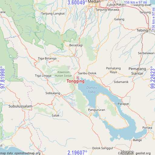
Tongging GPS coordinates[2]
2° 53' 54.6" North, 98° 31' 23.16" East
| Map corner | latitude | longitude |
|---|---|---|
| Upper-left | 3.60049°, | 97.81998° |
| Center: | 2.8985°, | 98.5231° |
| Lower-right: | 2.19607°, | 99.22623° |
| Map W x H: | 156.2×156.2 km | = 97.1×97.1mi |
| max Lat: | 5.88969° ⇑2.1% North |
| Tongging: | 2.8985° |
| min Lat: | ⇓97.9% South -10.934° |
| min Long | Tongging | max Long |
| 95.1345° | 98.5231° | 140.9419° |
| W 1.8%⇐ | ⇒98.2% E |
Elevation
Elevation of Tongging is 926 m = 3038 ft, and this is 696.3 m = 2284 ft above average elevation for this country.
| Max E: |
3185 m = 10449 ft | 3.3% |
| Tongging | 926 m 3038 ft | |
| Avg. | 229.7 m = 754 ft | |
Min E: |
-1 m = -3 ft | 96.7% |
See also: Indonesia elevation on elevation.city.
Geographical zone
Tongging is located in North Torrid zone (between Equator and Tropic of Cancer). Distance of Equator is 322.3 km =200.3 mi to South.| Distance of | km | miles | from Tongging |
|---|---|---|---|
| North Pole | 9684.8 | 6017.9 | to North |
| Arctic Circle | 7078.9 | 4398.6 | to North |
| Tropic Cancer | 2283.6 | 1419 | to North |
| Equator | 322.3 | 200.3 | to South |


Nearby cities:
15 places around Tongging: (largest is in red/bold)
• Ambarita
41.9 km =26 mi,  125°
125°
• Berastagi
33 km =20.5 mi,  357°
357°
• Harian
41.1 km =25.5 mi,  157°
157°
• Kabanjahe
22.7 km =14.1 mi,  350°
350°
• Pangururan
37.6 km =23.4 mi,  149°
149°
• Pematang Raya
36.8 km =22.9 mi,  78°
78°
• Salak
44 km =27.3 mi,  210°
210°
• Saribudolok
10.7 km =6.6 mi,  65°
65°
• Sarimatondang
43.7 km =27.2 mi,  95°
95°
• Sidikalang
28.7 km =17.8 mi,  234°
234°
• Sipintuangin
31.2 km =19.4 mi,  107°
107°
• Sondi
38.5 km =23.9 mi, 77°
• Sukarama
37.3 km =23.2 mi,  221°
221°
• Sumbul
22.4 km =13.9 mi, 218°
• Tigarunggu
22.2 km =13.8 mi,  90°
90°
Sources, notices
• [Note1] Compared only with cities in Indonesia existing in our database
• [Src1] Map data: © OpenStreetMap contributors (CC-BY-SA)
• [Src2] Other city data from geonames.org with taken over terms of usage.
• [Src3] Geographical zone / Annual Mean Temperature by Robert A. Rohde @ Wikipedia
