Pintupadang geodata
Pintupadang (North Sumatra) is a seat of a third-order administrative division; located in Indonesia in Asia/Jakarta (GMT+7) time zone. In our database, there are 407 cities with bigger population. Compared to other cities in Indonesia, 96.5% of cities are located further ↓South; 97.7% of cities are located further →East and 67.7% of cities have lower elevation than Pintupadang. Note1


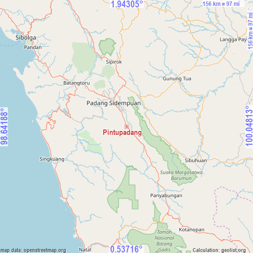
Pintupadang GPS coordinates[2]
1° 14' 24.72" North, 99° 20' 42" East
| Map corner | latitude | longitude |
|---|---|---|
| Upper-left | 1.94305°, | 98.64188° |
| Center: | 1.2402°, | 99.345° |
| Lower-right: | 0.53716°, | 100.04813° |
| Map W x H: | 156.3×156.3 km | = 97.1×97.1mi |
| max Lat: | 5.88969° ⇑3.5% North |
| Pintupadang: | 1.2402° |
| min Lat: | ⇓96.5% South -10.934° |
| min Long | Pintupadang | max Long |
| 95.1345° | 99.345° | 140.9419° |
| W 2.3%⇐ | ⇒97.7% E |
Elevation
Elevation of Pintupadang is 260 m = 853 ft, and this is 30.3 m = 99 ft above average elevation for this country.
| Max E: |
3185 m = 10449 ft | 32.3% |
| Pintupadang | 260 m 853 ft | |
| Avg. | 229.7 m = 754 ft | |
Min E: |
-1 m = -3 ft | 67.7% |
See also: Indonesia elevation on elevation.city.
Geographical zone
Pintupadang is located in North Torrid zone (between Equator and Tropic of Cancer). Distance of Equator is 137.9 km =85.7 mi to South.| Distance of | km | miles | from Pintupadang |
|---|---|---|---|
| North Pole | 9869.2 | 6132.4 | to North |
| Arctic Circle | 7263.3 | 4513.2 | to North |
| Tropic Cancer | 2468 | 1533.5 | to North |
| Equator | 137.9 | 85.7 | to South |


Nearby cities:
15 places around Pintupadang: (largest is in red/bold)
• Batangtoru
41.1 km =25.5 mi,  310°
310°
• Binanga
51.5 km =32 mi,  68°
68°
• Gunung Tua
43.5 km =27 mi,  45°
45°
• Kotanopan
75.4 km =46.9 mi,  147°
147°
• Muara Soma
61.4 km =38.2 mi,  178°
178°
• Padangsidempuan
17.5 km =10.9 mi,  332°
332°
• Panyambungan
47.7 km =29.6 mi, 151°
• Pasarujungbatu
70.8 km =44 mi,  108°
108°
• Sarulla
65.9 km =40.9 mi,  337°
337°
• Siabu
30 km =18.6 mi, 146°
• Sibuhuan
47.6 km =29.6 mi,  115°
115°
• Sipagimbar
65.7 km =40.8 mi,  2°
2°
• Sipiongot
75 km =46.6 mi,  28°
28°
• Sipirok
41.1 km =25.5 mi,  348°
348°
• Ujungbatu
69.1 km =42.9 mi, 108°
Sources, notices
• [Note1] Compared only with cities in Indonesia existing in our database
• [Src1] Map data: © OpenStreetMap contributors (CC-BY-SA)
• [Src2] Other city data from geonames.org with taken over terms of usage.
• [Src3] Geographical zone / Annual Mean Temperature by Robert A. Rohde @ Wikipedia
