Subang geodata
Subang (West Java) is a seat of a second-order administrative division; located in Indonesia in Asia/Jakarta (GMT+7) time zone. In our database, there are 407 cities with bigger population. Compared to other cities in Indonesia, 83.1% of cities are located further ↓South; 83.3% of cities are located further →East and 51.7% of cities have higher elevation than Subang. Note1


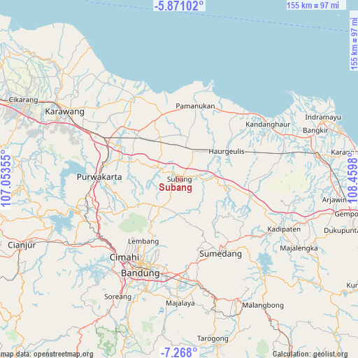
Subang GPS coordinates[2]
6° 34' 12" South, 107° 45' 24.012" East
| Map corner | latitude | longitude |
|---|---|---|
| Upper-left | -5.87102°, | 107.05355° |
| Center: | -6.57°, | 107.75667° |
| Lower-right: | -7.268°, | 108.4598° |
| Map W x H: | 155.3×155.3 km | = 96.5×96.5mi |
| max Lat: | 5.88969° ⇑16.9% North |
| Subang: | -6.57° |
| min Lat: | ⇓83.1% South -10.934° |
| min Long | Subang | max Long |
| 95.1345° | 107.75667° | 140.9419° |
| W 16.7%⇐ | ⇒83.3% E |
Elevation
Elevation of Subang is 96 m = 315 ft, and this is 133.7 m = 439 ft below average elevation for this country.
| Max E: |
3185 m = 10449 ft | 51.7% |
| Avg. | 229.7 m = 754 ft | |
| Subang | 96 m = 315 ft | |
Min E: |
-1 m = -3 ft | 48.3% |
See also: Indonesia elevation on elevation.city.
Geographical zone
Subang is located in South Torrid zone (between Equator and Tropic of Capricorn). Distance of Equator is 730.5 km =453.9 mi to North.| Distance of | km | miles | from Subang |
|---|---|---|---|
| Equator | 730.5 | 453.9 | to North |
| Tropic Capricorn | 1875.4 | 1165.3 | to South |
| Antarctic Circle | 6670.7 | 4145 | to South |
| South Pole | 9276.5 | 5764.1 | to South |


Nearby cities:
15 places around Subang: (largest is in red/bold)
• Bandung
42.5 km =26.4 mi,  202°
202°
• Cigorowong Kidul
52.2 km =32.4 mi,  164°
164°
• Cikampek
37.2 km =23.1 mi,  296°
296°
• Cileunyi
41 km =25.5 mi,  180°
180°
• Cimahi
41.1 km =25.5 mi,  215°
215°
• Lembang
31 km =19.3 mi,  209°
209°
• Margabakti
51.1 km =31.8 mi, 164°
• Margahayukencana
49.2 km =30.6 mi, 205°
• Padalarang
43.2 km =26.8 mi,  226°
226°
• Pamanukan
32.3 km =20.1 mi,  10°
10°
• Pameungpeuk
52.6 km =32.7 mi, 198°
• Purwakarta
34.6 km =21.5 mi,  272°
272°
• Saar Kaler
54.2 km =33.7 mi, 159°
• Sumedang
36.6 km =22.7 mi,  151°
151°
• Sumedang Utara
35.8 km =22.2 mi, 150°
Sources, notices
• [Note1] Compared only with cities in Indonesia existing in our database
• [Src1] Map data: © OpenStreetMap contributors (CC-BY-SA)
• [Src2] Other city data from geonames.org with taken over terms of usage.
• [Src3] Geographical zone / Annual Mean Temperature by Robert A. Rohde @ Wikipedia
