Pamanukan geodata
Pamanukan (West Java) is a populated place; located in Indonesia in Asia/Jakarta (GMT+7) time zone. With population of 114,290 people, there are 114 cities with bigger population in this country. Compared to other cities in Indonesia, 86.9% of cities are located further ↓South; 82.9% of cities are located further →East and 90.6% of cities have higher elevation than Pamanukan. Note1


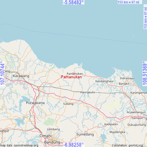
Pamanukan GPS coordinates[2]
6° 17' 3.012" South, 107° 48' 38.016" East
| Map corner | latitude | longitude |
|---|---|---|
| Upper-left | -5.58482°, | 107.10744° |
| Center: | -6.28417°, | 107.81056° |
| Lower-right: | -6.98258°, | 108.51369° |
| Map W x H: | 155.4×155.4 km | = 96.6×96.6mi |
| max Lat: | 5.88969° ⇑13.1% North |
| Pamanukan: | -6.28417° |
| min Lat: | ⇓86.9% South -10.934° |
| min Long | Pamanukan | max Long |
| 95.1345° | 107.81056° | 140.9419° |
| W 17.1%⇐ | ⇒82.9% E |
Elevation
Elevation of Pamanukan is 10 m = 33 ft, and this is 219.7 m = 721 ft below average elevation for this country.
| Max E: |
3185 m = 10449 ft | 90.6% |
| Avg. | 229.7 m = 754 ft | |
| Pamanukan | 10 m = 33 ft | |
Min E: |
-1 m = -3 ft | 9.4% |
See also: Pamanukan elevation on elevation.city.
Geographical zone
Pamanukan is located in South Torrid zone (between Equator and Tropic of Capricorn). Distance of Equator is 698.7 km =434.2 mi to North.| Distance of | km | miles | from Pamanukan |
|---|---|---|---|
| Equator | 698.7 | 434.2 | to North |
| Tropic Capricorn | 1907.2 | 1185.1 | to South |
| Antarctic Circle | 6702.4 | 4164.7 | to South |
| South Pole | 9308.3 | 5783.9 | to South |


Nearby cities:
15 places around Pamanukan: (largest is in red/bold)
• Cikampek
42 km =26.1 mi,  248°
248°
• Cikarang
72.7 km =45.2 mi,  272°
272°
• Cileunyi
73.1 km =45.4 mi,  185°
185°
• Cimahi
71.8 km =44.6 mi,  204°
204°
• Indramayu
56.5 km =35.1 mi,  94°
94°
• Jatibarang
59.7 km =37.1 mi,  110°
110°
• Jatiwangi
70.7 km =43.9 mi,  135°
135°
• Karawang
55.9 km =34.7 mi, 267°
• Lembang
62.4 km =38.8 mi, 199°
• Padalarang
72 km =44.7 mi,  211°
211°
• Purwakarta
50.7 km =31.5 mi,  233°
233°
• Rengasdengklok
58.3 km =36.2 mi,  283°
283°
• Subang
32.3 km =20.1 mi, 190°
• Sumedang
64.9 km =40.3 mi,  169°
169°
• Sumedang Utara
64 km =39.8 mi, 169°
Sources, notices
• [Note1] Compared only with cities in Indonesia existing in our database
• [Src1] Map data: © OpenStreetMap contributors (CC-BY-SA)
• [Src2] Other city data from geonames.org with taken over terms of usage.
• [Src3] Geographical zone / Annual Mean Temperature by Robert A. Rohde @ Wikipedia
