Kendal geodata
Kendal (Central Java) is a seat of a second-order administrative division; located in Indonesia in Asia/Jakarta (GMT+7) time zone. In our database, there are 407 cities with bigger population. Compared to other cities in Indonesia, 71.2% of cities are located further ↓South; 65.7% of cities are located further →East and 97.2% of cities have higher elevation than Kendal. Note1


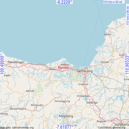
Kendal GPS coordinates[2]
6° 55' 16.68" South, 110° 12' 7.92" East
| Map corner | latitude | longitude |
|---|---|---|
| Upper-left | -6.2228°, | 109.49908° |
| Center: | -6.9213°, | 110.2022° |
| Lower-right: | -7.61877°, | 110.90533° |
| Map W x H: | 155.2×155.2 km | = 96.4×96.4mi |
| max Lat: | 5.88969° ⇑28.8% North |
| Kendal: | -6.9213° |
| min Lat: | ⇓71.2% South -10.934° |
| min Long | Kendal | max Long |
| 95.1345° | 110.2022° | 140.9419° |
| W 34.3%⇐ | ⇒65.7% E |
Elevation
Elevation of Kendal is 6 m = 20 ft, and this is 223.7 m = 734 ft below average elevation for this country.
| Max E: |
3185 m = 10449 ft | 97.2% |
| Avg. | 229.7 m = 754 ft | |
| Kendal | 6 m = 20 ft | |
Min E: |
-1 m = -3 ft | 2.8% |
See also: Indonesia elevation on elevation.city.
Geographical zone
Kendal is located in South Torrid zone (between Equator and Tropic of Capricorn). Distance of Equator is 769.6 km =478.2 mi to North.| Distance of | km | miles | from Kendal |
|---|---|---|---|
| Equator | 769.6 | 478.2 | to North |
| Tropic Capricorn | 1836.3 | 1141 | to South |
| Antarctic Circle | 6631.6 | 4120.7 | to South |
| South Pole | 9237.5 | 5739.9 | to South |


Nearby cities:
15 places around Kendal: (largest is in red/bold)
• Ambarawa
43.7 km =27.2 mi,  150°
150°
• Batang
52.1 km =32.4 mi,  271°
271°
• Demak
48.4 km =30.1 mi,  85°
85°
• Gunung Kendil
50.8 km =31.6 mi, 153°
• Magelang
61.1 km =38 mi,  178°
178°
• Mranggen
36.5 km =22.7 mi,  108°
108°
• Pecangaan
61.4 km =38.2 mi,  66°
66°
• Pekalongan
58.3 km =36.2 mi, 273°
• Salatiga
55.8 km =34.7 mi,  144°
144°
• Semarang
25.4 km =15.8 mi, 108°
• Temanggung
44.3 km =27.5 mi, 181°
• Ungaran
33 km =20.5 mi, 137°
• Welahan
58.4 km =36.3 mi,  76°
76°
• Weleri
16 km =9.9 mi,  249°
249°
• Wonosobo
58.8 km =36.5 mi,  214°
214°
Sources, notices
• [Note1] Compared only with cities in Indonesia existing in our database
• [Src1] Map data: © OpenStreetMap contributors (CC-BY-SA)
• [Src2] Other city data from geonames.org with taken over terms of usage.
• [Src3] Geographical zone / Annual Mean Temperature by Robert A. Rohde @ Wikipedia
