Baturaden geodata
Baturaden (Central Java) is a populated place; located in Indonesia in Asia/Jakarta (GMT+7) time zone. With population of 42,394 people, there are 262 cities with bigger population in this country. Compared to other cities in Indonesia, 51.2% of cities are located further ↓South; 66.2% of cities are located further →East and 97.4% of cities have lower elevation than Baturaden. Note1


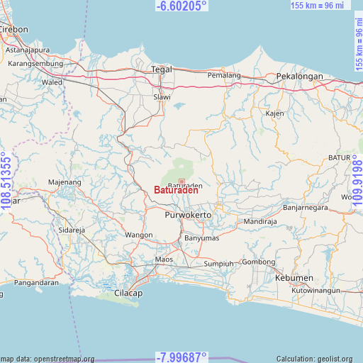
Baturaden GPS coordinates[2]
7° 18' 0" South, 109° 13' 0.012" East
| Map corner | latitude | longitude |
|---|---|---|
| Upper-left | -6.60205°, | 108.51355° |
| Center: | -7.3°, | 109.21667° |
| Lower-right: | -7.99687°, | 109.9198° |
| Map W x H: | 155.1×155.1 km | = 96.4×96.4mi |
| max Lat: | 5.88969° ⇑48.8% North |
| Baturaden: | -7.3° |
| min Lat: | ⇓51.2% South -10.934° |
| min Long | Baturaden | max Long |
| 95.1345° | 109.21667° | 140.9419° |
| W 33.8%⇐ | ⇒66.2% E |
Elevation
Elevation of Baturaden is 980 m = 3215 ft, and this is 750.3 m = 2462 ft above average elevation for this country.
| Max E: |
3185 m = 10449 ft | 2.6% |
| Baturaden | 980 m 3215 ft | |
| Avg. | 229.7 m = 754 ft | |
Min E: |
-1 m = -3 ft | 97.4% |
See also: Baturaden elevation on elevation.city.
Geographical zone
Baturaden is located in South Torrid zone (between Equator and Tropic of Capricorn). Distance of Equator is 811.7 km =504.4 mi to North.| Distance of | km | miles | from Baturaden |
|---|---|---|---|
| Equator | 811.7 | 504.4 | to North |
| Tropic Capricorn | 1794.2 | 1114.9 | to South |
| Antarctic Circle | 6589.5 | 4094.5 | to South |
| South Pole | 9195.4 | 5713.8 | to South |


Nearby cities:
15 places around Baturaden: (largest is in red/bold)
• Banyumas
25.3 km =15.7 mi,  160°
160°
• Binangun
26.6 km =16.5 mi,  172°
172°
• Gambarsari
25.8 km =16 mi,  183°
183°
• Garbi
22.5 km =14 mi, 180°
• Kebasen
26 km =16.2 mi, 184°
• Papringan
22.9 km =14.2 mi, 171°
• Pesawahan
25.5 km =15.8 mi,  192°
192°
• Purbalingga
19 km =11.8 mi,  121°
121°
• Purwokerto
13.6 km =8.5 mi, 171°
• Randudongkal
25.4 km =15.8 mi,  27°
27°
• Rawalo
26.7 km =16.6 mi, 188°
• Sokaraja
19.3 km =12 mi, 155°
• Tinggarwangi
27 km =16.8 mi,  202°
202°
• Tipar
24 km =14.9 mi, 198°
• Tugu
25.4 km =15.8 mi, 200°
Sources, notices
• [Note1] Compared only with cities in Indonesia existing in our database
• [Src1] Map data: © OpenStreetMap contributors (CC-BY-SA)
• [Src2] Other city data from geonames.org with taken over terms of usage.
• [Src3] Geographical zone / Annual Mean Temperature by Robert A. Rohde @ Wikipedia
