Kilmessan geodata
Kilmessan (Leinster) is a populated place; located in Ireland in Europe/Dublin (GMT+1) time zone. With population of 586 people, there are 484 cities with bigger population in this country. Compared to other cities in Ireland, 74.4% of cities are located further ↓South; 69.8% of cities are located further ←West and 65.1% of cities have lower elevation than Kilmessan. Note1


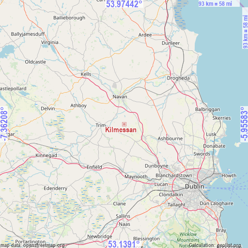
Kilmessan GPS coordinates[2]
53° 33' 31.752" North, 6° 39' 32.22" West
| Map corner | latitude | longitude |
|---|---|---|
| Upper-left | 53.97442°, | -7.36208° |
| Center: | 53.55882°, | -6.65895° |
| Lower-right: | 53.1391°, | -5.95583° |
| Map W x H: | 92.9×92.9 km | = 57.7×57.7mi |
| max Lat: | 55.25° ⇑25.6% North |
| Kilmessan: | 53.55882° |
| min Lat: | ⇓74.4% South 51.52487° |
| min Long | Kilmessan | max Long |
| -10.26889° | -6.65895° | -6.04944° |
| W 69.8%⇐ | ⇒30.2% E |
Elevation
Elevation of Kilmessan is 64 m = 210 ft, and this is 9.5 m = 31 ft above average elevation for this country.
| Max E: |
262 m = 860 ft | 34.9% |
| Kilmessan | 64 m 210 ft | |
| Avg. | 54.5 m = 179 ft | |
Min E: |
0 m = 0 ft | 65.1% |
See also: Ireland elevation on elevation.city.
Geographical zone
Kilmessan is located in North temperate zone (between Tropic of Cancer and the Arctic Circle). Distance of this North polar circle is 1446 km =898.5 mi to North.| Distance of | km | miles | from Kilmessan |
|---|---|---|---|
| North Pole | 4051.9 | 2517.7 | to North |
| Arctic Circle | 1446 | 898.5 | to North |
| Tropic Cancer | 3349.3 | 2081.2 | to South |
| Equator | 5955.2 | 3700.4 | to South |


Nearby cities:
15 places around Kilmessan: (largest is in red/bold)
• Ashbourne
18 km =11.2 mi,  106°
106°
• Athboy
18.3 km =11.4 mi,  293°
293°
• Duleek
19.2 km =11.9 mi,  55°
55°
• Dunboyne
19.8 km =12.3 mi,  141°
141°
• Dunshaughlin
9.4 km =5.8 mi,  123°
123°
• Kentstown
11.6 km =7.2 mi,  48°
48°
• Kilcock
17.4 km =10.8 mi,  182°
182°
• Kildalkey
16.3 km =10.1 mi,  274°
274°
• Maynooth
19.8 km =12.3 mi,  167°
167°
• Navan
10.6 km =6.6 mi,  351°
351°
• Newtown Trim
7.3 km =4.5 mi, 267°
• Ratoath
14.2 km =8.8 mi, 113°
• Slane
18.5 km =11.5 mi,  24°
24°
• Summerhill
10.4 km =6.5 mi,  209°
209°
• Trim
8.8 km =5.5 mi, 267°
Sources, notices
• [Note1] Compared only with cities in Ireland existing in our database
• [Src1] Map data: © OpenStreetMap contributors (CC-BY-SA)
• [Src2] Other city data from geonames.org with taken over terms of usage.
• [Src3] Geographical zone / Annual Mean Temperature by Robert A. Rohde @ Wikipedia
