Edgeworthstown geodata
Edgeworthstown (Leinster) is a populated place; located in Ireland in Europe/Dublin (GMT+1) time zone. With population of 1,744 people, there are 249 cities with bigger population in this country. Compared to other cities in Ireland, 78.4% of cities are located further ↓South; 54.8% of cities are located further →East and 83.5% of cities have lower elevation than Edgeworthstown. Note1


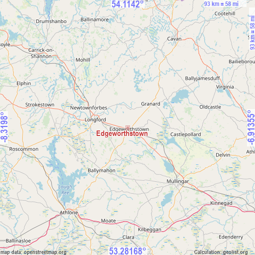
Edgeworthstown GPS coordinates[2]
53° 42' 0" North, 7° 37' 0.012" West
| Map corner | latitude | longitude |
|---|---|---|
| Upper-left | 54.1142°, | -8.3198° |
| Center: | 53.7°, | -7.61667° |
| Lower-right: | 53.28168°, | -6.91355° |
| Map W x H: | 92.6×92.6 km | = 57.5×57.5mi |
| max Lat: | 55.25° ⇑21.6% North |
| Edgeworthstown: | 53.7° |
| min Lat: | ⇓78.4% South 51.52487° |
| min Long | Edgeworthstown | max Long |
| -10.26889° | -7.61667° | -6.04944° |
| W 45.2%⇐ | ⇒54.8% E |
Elevation
Elevation of Edgeworthstown is 93 m = 305 ft, and this is 38.5 m = 126 ft above average elevation for this country.
| Max E: |
262 m = 860 ft | 16.5% |
| Edgeworthstown | 93 m 305 ft | |
| Avg. | 54.5 m = 179 ft | |
Min E: |
0 m = 0 ft | 83.5% |
See also: Ireland elevation on elevation.city.
Geographical zone
Edgeworthstown is located in North temperate zone (between Tropic of Cancer and the Arctic Circle). Distance of this North polar circle is 1430.3 km =888.7 mi to North.| Distance of | km | miles | from Edgeworthstown |
|---|---|---|---|
| North Pole | 4036.2 | 2508 | to North |
| Arctic Circle | 1430.3 | 888.7 | to North |
| Tropic Cancer | 3365 | 2090.9 | to South |
| Equator | 5970.9 | 3710.1 | to South |


Nearby cities:
15 places around Edgeworthstown: (largest is in red/bold)
• An Muileann gCearr
26.8 km =16.7 mi,  136°
136°
• Ballinagh
29.1 km =18.1 mi,  26°
26°
• Ballyjamesduff
32.8 km =20.4 mi,  55°
55°
• Ballymahon
17.8 km =11.1 mi,  213°
213°
• Castlepollard
21.1 km =13.1 mi,  96°
96°
• Drumlish
16.3 km =10.1 mi,  322°
322°
• Granard
11.9 km =7.4 mi,  42°
42°
• Lanesborough
24.4 km =15.2 mi,  261°
261°
• Longford
12.3 km =7.6 mi,  283°
283°
• Moate
17.9 km =11.1 mi,  201°
201°
• Mohill
29.2 km =18.1 mi,  325°
325°
• Newtownforbes
16.1 km =10 mi,  297°
297°
• Oldcastle
30.8 km =19.1 mi,  76°
76°
• Roosky
24.7 km =15.3 mi,  306°
306°
• Strokestown
33.1 km =20.6 mi,  286°
286°
Sources, notices
• [Note1] Compared only with cities in Ireland existing in our database
• [Src1] Map data: © OpenStreetMap contributors (CC-BY-SA)
• [Src2] Other city data from geonames.org with taken over terms of usage.
• [Src3] Geographical zone / Annual Mean Temperature by Robert A. Rohde @ Wikipedia
