Castlepollard geodata
Castlepollard (Leinster) is a populated place; located in Ireland in Europe/Dublin (GMT+0) time zone. With population of 1,042 people, there are 342 cities with bigger population in this country. Compared to other cities in Ireland, 77.8% of cities are located further ↓South; 52.4% of cities are located further ←West and 79.1% of cities have lower elevation than Castlepollard. Note1


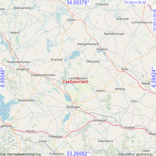
Castlepollard GPS coordinates[2]
53° 40' 45.66" North, 7° 17' 50.496" West
| Map corner | latitude | longitude |
|---|---|---|
| Upper-left | 54.09376°, | -8.00049° |
| Center: | 53.67935°, | -7.29736° |
| Lower-right: | 53.26082°, | -6.59424° |
| Map W x H: | 92.6×92.6 km | = 57.5×57.5mi |
| max Lat: | 55.25° ⇑22.2% North |
| Castlepollard: | 53.67935° |
| min Lat: | ⇓77.8% South 51.52487° |
| min Long | Castlepollard | max Long |
| -10.26889° | -7.29736° | -6.04944° |
| W 52.4%⇐ | ⇒47.6% E |
Elevation
Elevation of Castlepollard is 87 m = 285 ft, and this is 32.5 m = 107 ft above average elevation for this country.
| Max E: |
262 m = 860 ft | 20.9% |
| Castlepollard | 87 m 285 ft | |
| Avg. | 54.5 m = 179 ft | |
Min E: |
0 m = 0 ft | 79.1% |
See also: Ireland elevation on elevation.city.
Geographical zone
Castlepollard is located in North temperate zone (between Tropic of Cancer and the Arctic Circle). Distance of this North polar circle is 1432.6 km =890.2 mi to North.| Distance of | km | miles | from Castlepollard |
|---|---|---|---|
| North Pole | 4038.5 | 2509.4 | to North |
| Arctic Circle | 1432.6 | 890.2 | to North |
| Tropic Cancer | 3362.7 | 2089.5 | to South |
| Equator | 5968.6 | 3708.7 | to South |


Nearby cities:
15 places around Castlepollard: (largest is in red/bold)
• An Muileann gCearr
17.4 km =10.8 mi,  188°
188°
• Athboy
26 km =16.2 mi,  103°
103°
• Ballivor
27.6 km =17.1 mi,  126°
126°
• Ballyjamesduff
21.6 km =13.4 mi,  16°
16°
• Clonmellon
18.5 km =11.5 mi, 95°
• Delvin
15.5 km =9.6 mi,  119°
119°
• Edgeworthstown
21.1 km =13.1 mi,  276°
276°
• Granard
17.1 km =10.6 mi,  310°
310°
• Kells
28 km =17.4 mi,  79°
79°
• Kildalkey
28.6 km =17.8 mi, 115°
• Kinnegad
28.4 km =17.6 mi,  152°
152°
• Mullagh
27.2 km =16.9 mi,  56°
56°
• Oldcastle
13.1 km =8.1 mi,  42°
42°
• Rathwire
21.9 km =13.6 mi, 150°
• Virginia
22.5 km =14 mi, 40°
Sources, notices
• [Note1] Compared only with cities in Ireland existing in our database
• [Src1] Map data: © OpenStreetMap contributors (CC-BY-SA)
• [Src2] Other city data from geonames.org with taken over terms of usage.
• [Src3] Geographical zone / Annual Mean Temperature by Robert A. Rohde @ Wikipedia
