Ballyjamesduff geodata
Ballyjamesduff (Ulster) is a populated place; located in Ireland in Europe/Dublin (GMT+1) time zone. With population of 2,568 people, there are 202 cities with bigger population in this country. Compared to other cities in Ireland, 83.9% of cities are located further ↓South; 54.1% of cities are located further ←West and 91.7% of cities have lower elevation than Ballyjamesduff. Note1


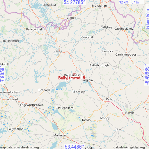
Ballyjamesduff GPS coordinates[2]
53° 51' 55.008" North, 7° 12' 10.008" West
| Map corner | latitude | longitude |
|---|---|---|
| Upper-left | 54.27785°, | -7.9059° |
| Center: | 53.86528°, | -7.20278° |
| Lower-right: | 53.4486°, | -6.49965° |
| Map W x H: | 92.2×92.2 km | = 57.3×57.3mi |
| max Lat: | 55.25° ⇑16.1% North |
| Ballyjamesduff: | 53.86528° |
| min Lat: | ⇓83.9% South 51.52487° |
| min Long | Ballyjamesduff | max Long |
| -10.26889° | -7.20278° | -6.04944° |
| W 54.1%⇐ | ⇒45.9% E |
Elevation
Elevation of Ballyjamesduff is 110 m = 361 ft, and this is 55.5 m = 182 ft above average elevation for this country.
| Max E: |
262 m = 860 ft | 8.3% |
| Ballyjamesduff | 110 m 361 ft | |
| Avg. | 54.5 m = 179 ft | |
Min E: |
0 m = 0 ft | 91.7% |
See also: Ireland elevation on elevation.city.
Geographical zone
Ballyjamesduff is located in North temperate zone (between Tropic of Cancer and the Arctic Circle). Distance of this North polar circle is 1411.9 km =877.3 mi to North.| Distance of | km | miles | from Ballyjamesduff |
|---|---|---|---|
| North Pole | 4017.8 | 2496.5 | to North |
| Arctic Circle | 1411.9 | 877.3 | to North |
| Tropic Cancer | 3383.3 | 2102.3 | to South |
| Equator | 5989.3 | 3721.6 | to South |


Nearby cities:
15 places around Ballyjamesduff: (largest is in red/bold)
• Bailieborough
16.5 km =10.3 mi,  69°
69°
• Ballinagh
15.9 km =9.9 mi,  298°
298°
• Ballyhaise
21.8 km =13.5 mi,  340°
340°
• Carlanstown
26.5 km =16.5 mi,  116°
116°
• Castlepollard
21.6 km =13.4 mi,  196°
196°
• Cavan
17.4 km =10.8 mi,  323°
323°
• Clonmellon
25.5 km =15.8 mi,  151°
151°
• Cootehill
24.4 km =15.2 mi,  18°
18°
• Granard
21.4 km =13.3 mi,  243°
243°
• Kells
26.3 km =16.3 mi,  126°
126°
• Kingscourt
26.5 km =16.5 mi,  79°
79°
• Mullagh
17.5 km =10.9 mi,  109°
109°
• Oldcastle
11.3 km =7 mi,  166°
166°
• Shercock
24.8 km =15.4 mi,  52°
52°
• Virginia
9 km =5.6 mi, 112°
Sources, notices
• [Note1] Compared only with cities in Ireland existing in our database
• [Src1] Map data: © OpenStreetMap contributors (CC-BY-SA)
• [Src2] Other city data from geonames.org with taken over terms of usage.
• [Src3] Geographical zone / Annual Mean Temperature by Robert A. Rohde @ Wikipedia
