Cherryville geodata
Cherryville (Leinster) is a populated place; located in Ireland in Europe/Dublin (GMT+1) time zone. With population of 6,380 people, there are 109 cities with bigger population in this country. Compared to other cities in Ireland, 54.8% of cities are located further ↑North; 59.8% of cities are located further ←West and 86.7% of cities have lower elevation than Cherryville. Note1


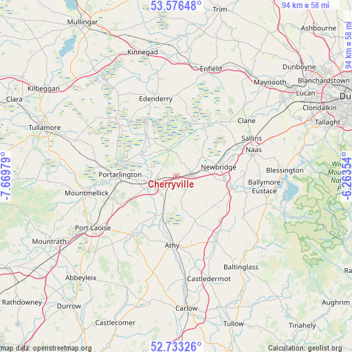
Cherryville GPS coordinates[2]
53° 9' 24.984" North, 6° 58' 0.012" West
| Map corner | latitude | longitude |
|---|---|---|
| Upper-left | 53.57648°, | -7.66979° |
| Center: | 53.15694°, | -6.96667° |
| Lower-right: | 52.73326°, | -6.26354° |
| Map W x H: | 93.8×93.8 km | = 58.3×58.3mi |
| max Lat: | 55.25° ⇑54.8% North |
| Cherryville: | 53.15694° |
| min Lat: | ⇓45.2% South 51.52487° |
| min Long | Cherryville | max Long |
| -10.26889° | -6.96667° | -6.04944° |
| W 59.8%⇐ | ⇒40.2% E |
Elevation
Elevation of Cherryville is 99 m = 325 ft, and this is 44.5 m = 146 ft above average elevation for this country.
| Max E: |
262 m = 860 ft | 13.3% |
| Cherryville | 99 m 325 ft | |
| Avg. | 54.5 m = 179 ft | |
Min E: |
0 m = 0 ft | 86.7% |
See also: Ireland elevation on elevation.city.
Geographical zone
Cherryville is located in North temperate zone (between Tropic of Cancer and the Arctic Circle). Distance of this North polar circle is 1490.7 km =926.3 mi to North.| Distance of | km | miles | from Cherryville |
|---|---|---|---|
| North Pole | 4096.6 | 2545.5 | to North |
| Arctic Circle | 1490.7 | 926.3 | to North |
| Tropic Cancer | 3304.6 | 2053.4 | to South |
| Equator | 5910.5 | 3672.6 | to South |


Nearby cities:
15 places around Cherryville: (largest is in red/bold)
• Allenwood Cross Roads
15.8 km =9.8 mi,  26°
26°
• Athgarvan
12.3 km =7.6 mi,  92°
92°
• Brownstown Cross Roads
8.7 km =5.4 mi,  103°
103°
• Calverstown
14 km =8.7 mi,  126°
126°
• Droichead Nua
11.7 km =7.3 mi,  76°
76°
• Kilcullen
15.1 km =9.4 mi, 101°
• Kildare
3.5 km =2.2 mi, 91°
• Killenard
12.4 km =7.7 mi,  257°
257°
• Kilmeage
13.4 km =8.3 mi,  38°
38°
• Monasterevin
6.9 km =4.3 mi,  254°
254°
• Old Kilcullen
14.6 km =9.1 mi,  112°
112°
• Portarlington
15 km =9.3 mi,  272°
272°
• Rathangan
7.4 km =4.6 mi,  345°
345°
• Robertstown
16.4 km =10.2 mi, 37°
• Suncroft
9.2 km =5.7 mi, 129°
Sources, notices
• [Note1] Compared only with cities in Ireland existing in our database
• [Src1] Map data: © OpenStreetMap contributors (CC-BY-SA)
• [Src2] Other city data from geonames.org with taken over terms of usage.
• [Src3] Geographical zone / Annual Mean Temperature by Robert A. Rohde @ Wikipedia
