Brownstown Cross Roads geodata
Brownstown Cross Roads (Leinster) is a populated place; located in Ireland in Europe/Dublin (GMT+1) time zone. With population of 846 people, there are 380 cities with bigger population in this country. Compared to other cities in Ireland, 56.2% of cities are located further ↑North; 64.3% of cities are located further ←West and 87.1% of cities have lower elevation than Brownstown Cross Roads. Note1


Brownstown Cross Roads GPS coordinates[2]
53° 8' 17.34" North, 6° 50' 24.864" West
| Map corner | latitude | longitude |
|---|---|---|
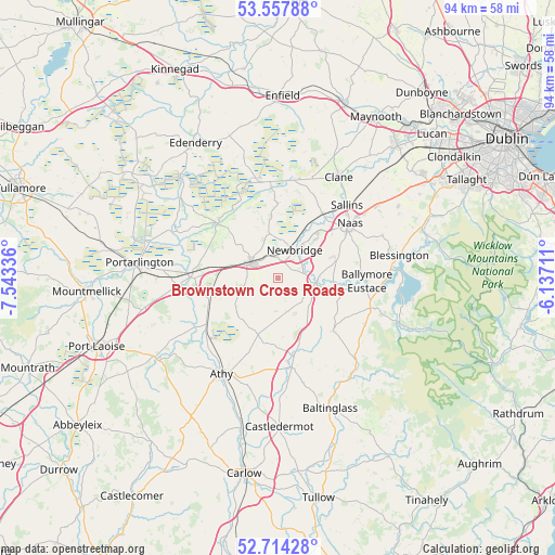
| Upper-left | 53.55788°, | -7.54336° |
| Center: | 53.13815°, | -6.84024° |
| Lower-right: | 52.71428°, | -6.13711° |
| Map W x H: | 93.8×93.8 km | = 58.3×58.3mi |
| max Lat: | 55.25° ⇑56.2% North |
| Brownstown Cross Roads: | 53.13815° |
| min Lat: | ⇓43.8% South 51.52487° |
| min Long | Brownstown Cros | max Long |
| -10.26889° | -6.84024° | -6.04944° |
| W 64.3%⇐ | ⇒35.7% E |
Elevation
Elevation of Brownstown Cross Roads is 100 m = 328 ft, and this is 45.5 m = 149 ft above average elevation for this country.
| Max E: |
262 m = 860 ft | 12.9% |
| Brownstown Cross Roads | 100 m 328 ft | |
| Avg. | 54.5 m = 179 ft | |
Min E: |
0 m = 0 ft | 87.1% |
See also: Ireland elevation on elevation.city.
Geographical zone
Brownstown Cross Roads is located in North temperate zone (between Tropic of Cancer and the Arctic Circle). Distance of this North polar circle is 1492.8 km =927.6 mi to North.| Distance of | km | miles | from Brownstown Cross Roads |
|---|---|---|---|
| North Pole | 4098.7 | 2546.8 | to North |
| Arctic Circle | 1492.8 | 927.6 | to North |
| Tropic Cancer | 3302.5 | 2052.1 | to South |
| Equator | 5908.4 | 3671.3 | to South |


Nearby cities:
15 places around Brownstown Cross Roads: (largest is in red/bold)
• Athgarvan
4.2 km =2.6 mi,  68°
68°
• Ballitore
14.7 km =9.1 mi,  174°
174°
• Ballymore Eustace
14.9 km =9.3 mi,  92°
92°
• Calverstown
6.8 km =4.2 mi,  155°
155°
• Carragh
13.2 km =8.2 mi,  34°
34°
• Cherryville
8.7 km =5.4 mi,  283°
283°
• Droichead Nua
5.7 km =3.5 mi, 30°
• Dunlavin
12.9 km =8 mi,  135°
135°
• Kilcullen
6.5 km =4 mi,  97°
97°
• Kildare
5.3 km =3.3 mi,  291°
291°
• Kilmeage
12.7 km =7.9 mi,  359°
359°
• Naas
14.4 km =8.9 mi,  53°
53°
• Old Kilcullen
6.1 km =3.8 mi,  125°
125°
• Rathangan
13.9 km =8.6 mi,  311°
311°
• Suncroft
4 km =2.5 mi,  200°
200°
Sources, notices
• [Note1] Compared only with cities in Ireland existing in our database
• [Src1] Map data: © OpenStreetMap contributors (CC-BY-SA)
• [Src2] Other city data from geonames.org with taken over terms of usage.
• [Src3] Geographical zone / Annual Mean Temperature by Robert A. Rohde @ Wikipedia
