Portarlington geodata
Portarlington (Leinster) is a populated place; located in Ireland in Europe/Dublin (GMT+1) time zone. With population of 7,788 people, there are 83 cities with bigger population in this country. Compared to other cities in Ireland, 54.6% of cities are located further ↑North; 54.5% of cities are located further ←West and 67.7% of cities have lower elevation than Portarlington. Note1


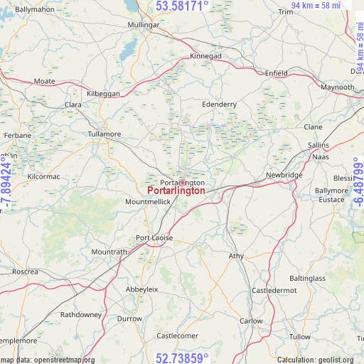
Portarlington GPS coordinates[2]
53° 9' 43.992" North, 7° 11' 27.996" West
| Map corner | latitude | longitude |
|---|---|---|
| Upper-left | 53.58171°, | -7.89424° |
| Center: | 53.16222°, | -7.19111° |
| Lower-right: | 52.73859°, | -6.48799° |
| Map W x H: | 93.7×93.7 km | = 58.2×58.2mi |
| max Lat: | 55.25° ⇑54.6% North |
| Portarlington: | 53.16222° |
| min Lat: | ⇓45.4% South 51.52487° |
| min Long | Portarlington | max Long |
| -10.26889° | -7.19111° | -6.04944° |
| W 54.5%⇐ | ⇒45.5% E |
Elevation
Elevation of Portarlington is 67 m = 220 ft, and this is 12.5 m = 41 ft above average elevation for this country.
| Max E: |
262 m = 860 ft | 32.3% |
| Portarlington | 67 m 220 ft | |
| Avg. | 54.5 m = 179 ft | |
Min E: |
0 m = 0 ft | 67.7% |
See also: Ireland elevation on elevation.city.
Geographical zone
Portarlington is located in North temperate zone (between Tropic of Cancer and the Arctic Circle). Distance of this North polar circle is 1490.1 km =925.9 mi to North.| Distance of | km | miles | from Portarlington |
|---|---|---|---|
| North Pole | 4096 | 2545.1 | to North |
| Arctic Circle | 1490.1 | 925.9 | to North |
| Tropic Cancer | 3305.2 | 2053.8 | to South |
| Equator | 5911.1 | 3673 | to South |


Nearby cities:
15 places around Portarlington: (largest is in red/bold)
• Brownstown Cross Roads
23.5 km =14.6 mi,  96°
96°
• Cherryville
15 km =9.3 mi,  92°
92°
• Clonaslee
22.3 km =13.9 mi,  265°
265°
• Daingean
16.3 km =10.1 mi,  336°
336°
• Edenderry
21.9 km =13.6 mi,  25°
25°
• Kildare
18.5 km =11.5 mi, 92°
• Killenard
4.3 km =2.7 mi,  138°
138°
• Monasterevin
8.7 km =5.4 mi,  106°
106°
• Mountmellick
10.2 km =6.3 mi,  237°
237°
• Portlaoise
16 km =9.9 mi,  207°
207°
• Rathangan
14.6 km =9.1 mi,  63°
63°
• Rhode
21.1 km =13.1 mi,  358°
358°
• Stradbally
16.5 km =10.3 mi,  171°
171°
• Suncroft
22.9 km =14.2 mi, 106°
• Tullamore
23.4 km =14.5 mi,  302°
302°
Sources, notices
• [Note1] Compared only with cities in Ireland existing in our database
• [Src1] Map data: © OpenStreetMap contributors (CC-BY-SA)
• [Src2] Other city data from geonames.org with taken over terms of usage.
• [Src3] Geographical zone / Annual Mean Temperature by Robert A. Rohde @ Wikipedia
