Ballyconnell geodata
Ballyconnell (Ulster) is a populated place; located in Ireland in Europe/Dublin (GMT+1) time zone. With population of 1,061 people, there are 338 cities with bigger population in this country. Compared to other cities in Ireland, 90.1% of cities are located further ↓South; 53.9% of cities are located further →East and 51.6% of cities have lower elevation than Ballyconnell. Note1


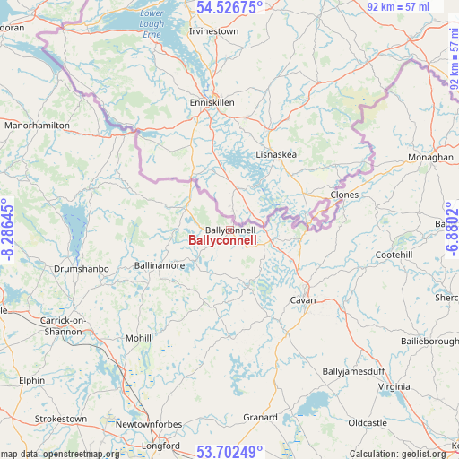
Ballyconnell GPS coordinates[2]
54° 7' 0.012" North, 7° 34' 59.988" West
| Map corner | latitude | longitude |
|---|---|---|
| Upper-left | 54.52675°, | -8.28645° |
| Center: | 54.11667°, | -7.58333° |
| Lower-right: | 53.70249°, | -6.8802° |
| Map W x H: | 91.6×91.6 km | = 56.9×56.9mi |
| max Lat: | 55.25° ⇑9.9% North |
| Ballyconnell: | 54.11667° |
| min Lat: | ⇓90.1% South 51.52487° |
| min Long | Ballyconnell | max Long |
| -10.26889° | -7.58333° | -6.04944° |
| W 46.1%⇐ | ⇒53.9% E |
Elevation
Elevation of Ballyconnell is 53 m = 174 ft, and this is 1.5 m = 5 ft below average elevation for this country.
| Max E: |
262 m = 860 ft | 48.4% |
| Avg. | 54.5 m = 179 ft | |
| Ballyconnell | 53 m = 174 ft | |
Min E: |
0 m = 0 ft | 51.6% |
See also: Ireland elevation on elevation.city.
Geographical zone
Ballyconnell is located in North temperate zone (between Tropic of Cancer and the Arctic Circle). Distance of this North polar circle is 1384 km =860 mi to North.| Distance of | km | miles | from Ballyconnell |
|---|---|---|---|
| North Pole | 3989.9 | 2479.2 | to North |
| Arctic Circle | 1384 | 860 | to North |
| Tropic Cancer | 3411.3 | 2119.7 | to South |
| Equator | 6017.2 | 3738.9 | to South |


Nearby cities:
15 places around Ballyconnell: (largest is in red/bold)
• Ballinagh
23.1 km =14.4 mi,  151°
151°
• Ballinamore
16 km =9.9 mi,  242°
242°
• Ballyhaise
18.9 km =11.7 mi,  113°
113°
• Ballyjamesduff
37.4 km =23.2 mi,  138°
138°
• Belturbet
8.9 km =5.5 mi,  102°
102°
• Carrick-on-Shannon
38.1 km =23.7 mi, 240°
• Cavan
20.2 km =12.6 mi,  133°
133°
• Clones
24 km =14.9 mi,  71°
71°
• Cootehill
33.1 km =20.6 mi, 98°
• Drumlish
35.4 km =22 mi,  199°
199°
• Drumshanbo
30.3 km =18.8 mi,  255°
255°
• Granard
38 km =23.6 mi,  171°
171°
• Mohill
28.9 km =18 mi,  219°
219°
• Newtownforbes
42.2 km =26.2 mi, 202°
• Roosky
38.3 km =23.8 mi,  214°
214°
Sources, notices
• [Note1] Compared only with cities in Ireland existing in our database
• [Src1] Map data: © OpenStreetMap contributors (CC-BY-SA)
• [Src2] Other city data from geonames.org with taken over terms of usage.
• [Src3] Geographical zone / Annual Mean Temperature by Robert A. Rohde @ Wikipedia
