Ballitore geodata
Ballitore (Leinster) is a populated place; located in Ireland in Europe/Dublin (GMT+1) time zone. With population of 685 people, there are 436 cities with bigger population in this country. Compared to other cities in Ireland, 60.9% of cities are located further ↑North; 64.7% of cities are located further ←West and 85% of cities have lower elevation than Ballitore. Note1


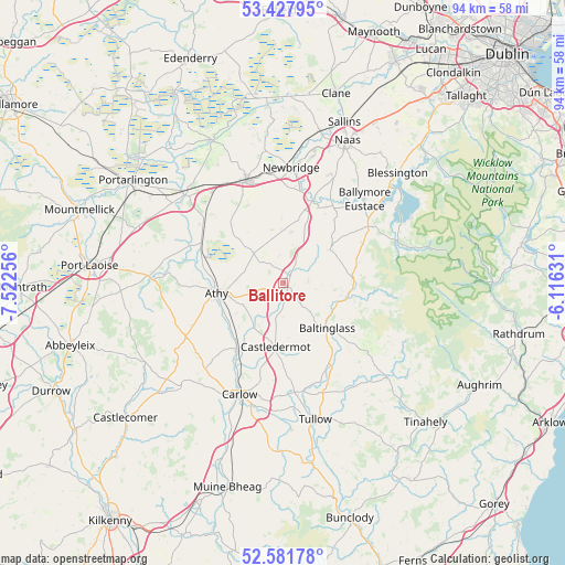
Ballitore GPS coordinates[2]
53° 0' 24.984" North, 6° 49' 9.984" West
| Map corner | latitude | longitude |
|---|---|---|
| Upper-left | 53.42795°, | -7.52256° |
| Center: | 53.00694°, | -6.81944° |
| Lower-right: | 52.58178°, | -6.11631° |
| Map W x H: | 94.1×94.1 km | = 58.5×58.5mi |
| max Lat: | 55.25° ⇑60.9% North |
| Ballitore: | 53.00694° |
| min Lat: | ⇓39.1% South 51.52487° |
| min Long | Ballitore | max Long |
| -10.26889° | -6.81944° | -6.04944° |
| W 64.7%⇐ | ⇒35.3% E |
Elevation
Elevation of Ballitore is 96 m = 315 ft, and this is 41.5 m = 136 ft above average elevation for this country.
| Max E: |
262 m = 860 ft | 15% |
| Ballitore | 96 m 315 ft | |
| Avg. | 54.5 m = 179 ft | |
Min E: |
0 m = 0 ft | 85% |
See also: Ireland elevation on elevation.city.
Geographical zone
Ballitore is located in North temperate zone (between Tropic of Cancer and the Arctic Circle). Distance of this North polar circle is 1507.4 km =936.7 mi to North.| Distance of | km | miles | from Ballitore |
|---|---|---|---|
| North Pole | 4113.2 | 2555.8 | to North |
| Arctic Circle | 1507.4 | 936.7 | to North |
| Tropic Cancer | 3287.9 | 2043 | to South |
| Equator | 5893.8 | 3662.2 | to South |


Nearby cities:
15 places around Ballitore: (largest is in red/bold)
• Athgarvan
16.4 km =10.2 mi,  8°
8°
• Athy
10.9 km =6.8 mi,  260°
260°
• Ballylinan
16.3 km =10.1 mi,  245°
245°
• Baltinglass
10.7 km =6.6 mi,  136°
136°
• Brownstown Cross Roads
14.7 km =9.1 mi,  354°
354°
• Calverstown
8.6 km =5.3 mi, 9°
• Castledermot
11 km =6.8 mi,  187°
187°
• Cherryville
19.4 km =12.1 mi,  329°
329°
• Dunlavin
9.4 km =5.8 mi,  55°
55°
• Kilcullen
14.6 km =9.1 mi,  20°
20°
• Kildare
17.8 km =11.1 mi,  339°
339°
• Moone
3.5 km =2.2 mi,  175°
175°
• Old Kilcullen
11.6 km =7.2 mi, 18°
• Rathvilly
16.6 km =10.3 mi,  149°
149°
• Suncroft
11.1 km =6.9 mi, 345°
Sources, notices
• [Note1] Compared only with cities in Ireland existing in our database
• [Src1] Map data: © OpenStreetMap contributors (CC-BY-SA)
• [Src2] Other city data from geonames.org with taken over terms of usage.
• [Src3] Geographical zone / Annual Mean Temperature by Robert A. Rohde @ Wikipedia
