pedda nakkalapalem geodata
pedda nakkalapalem (Andhra Pradesh) is a populated place; located in India in Asia/Kolkata (GMT+5.5) time zone. With population of 2,500 people, there are 3424 cities with bigger population in this country. Compared to other cities in India, 78.3% of cities are located further ↑North; 69.2% of cities are located further ←West and 85.8% of cities have higher elevation than pedda nakkalapalem. Note1


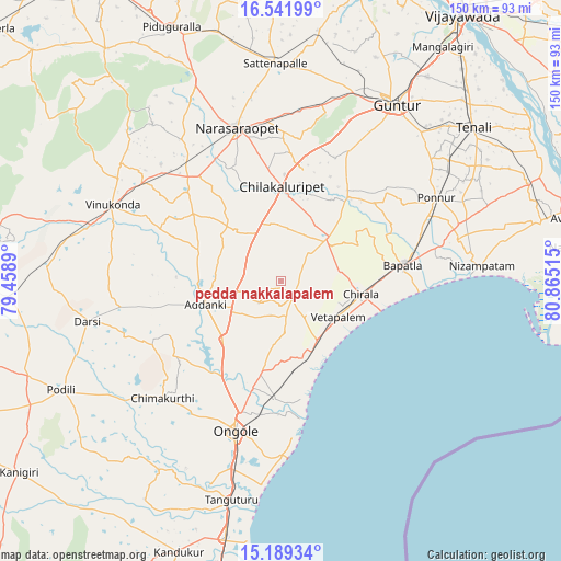
pedda nakkalapalem GPS coordinates[2]
15° 52' 0.48" North, 80° 9' 43.272" East
| Map corner | latitude | longitude |
|---|---|---|
| Upper-left | 16.54199°, | 79.4589° |
| Center: | 15.8668°, | 80.16202° |
| Lower-right: | 15.18934°, | 80.86515° |
| Map W x H: | 150.4×150.4 km | = 93.5×93.5mi |
| max Lat: | 34.9274° ⇑78.3% North |
| pedda nakkalapalem: | 15.8668° |
| min Lat: | ⇓21.7% South 8.09008° |
| min Long | pedda nakkalapa | max Long |
| 68.82655° | 80.16202° | 96.81° |
| W 69.2%⇐ | ⇒30.8% E |
Elevation
Elevation of pedda nakkalapalem is 28 m = 92 ft, and this is 267.6 m = 878 ft below average elevation for this country.
| Max E: |
3681 m = 12077 ft | 85.8% |
| Avg. | 295.6 m = 970 ft | |
| pedda nakkalapalem | 28 m = 92 ft | |
Min E: |
1 m = 3 ft | 14.2% |
See also: India elevation on elevation.city.
Geographical zone
pedda nakkalapalem is located in North Torrid zone (between Equator and Tropic of Cancer). Distance of this Northern Tropic circle is 841.7 km =523 mi to North.| Distance of | km | miles | from pedda nakkalapalem |
|---|---|---|---|
| North Pole | 8242.8 | 5121.8 | to North |
| Arctic Circle | 5637 | 3502.7 | to North |
| Tropic Cancer | 841.7 | 523 | to North |
| Equator | 1764.2 | 1096.2 | to South |


Nearby cities:
15 places around pedda nakkalapalem: (largest is in red/bold)
• Addanki
21.1 km =13.1 mi,  252°
252°
• Bāpatla
32.9 km =20.4 mi,  82°
82°
• Chilakalūrupet
24.8 km =15.4 mi,  1°
1°
• Chīrāla
20.9 km =13 mi,  103°
103°
• Darsi
52.7 km =32.7 mi,  258°
258°
• Govindapuram,Chilakaluripet,Guntur
32.6 km =20.3 mi,  348°
348°
• Guntur
57.6 km =35.8 mi,  33°
33°
• Narasaraopet
42.7 km =26.5 mi,  343°
343°
• Ongole
42.3 km =26.3 mi,  197°
197°
• Pavuluru
1.6 km =1 mi,  169°
169°
• Phirangipuram
48.3 km =30 mi,  12°
12°
• Ponnur
47.2 km =29.3 mi,  61°
61°
• Ponnūru
47.2 km =29.3 mi, 62°
• Vetapālem
17.9 km =11.1 mi,  120°
120°
• Vinukonda
49.7 km =30.9 mi,  294°
294°
Sources, notices
• [Note1] Compared only with cities in India existing in our database
• [Src1] Map data: © OpenStreetMap contributors (CC-BY-SA)
• [Src2] Other city data from geonames.org with taken over terms of usage.
• [Src3] Geographical zone / Annual Mean Temperature by Robert A. Rohde @ Wikipedia
