Uttiramerūr geodata
Uttiramerūr (Tamil Nadu) is a populated place; located in India in Asia/Kolkata (GMT+5.5) time zone. With population of 24,315 people, there are 1747 cities with bigger population in this country. Compared to other cities in India, 88.1% of cities are located further ↑North; 66.2% of cities are located further ←West and 76.1% of cities have higher elevation than Uttiramerūr. Note1


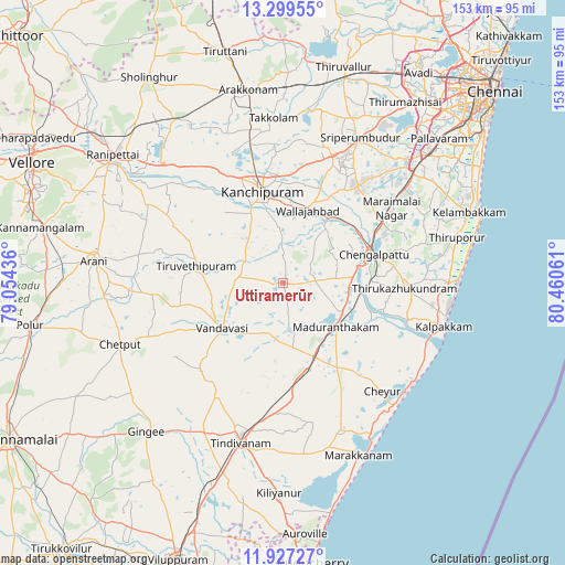
Uttiramerūr GPS coordinates[2]
12° 36' 51.588" North, 79° 45' 26.928" East
| Map corner | latitude | longitude |
|---|---|---|
| Upper-left | 13.29955°, | 79.05436° |
| Center: | 12.61433°, | 79.75748° |
| Lower-right: | 11.92727°, | 80.46061° |
| Map W x H: | 152.6×152.6 km | = 94.8×94.8mi |
| max Lat: | 34.9274° ⇑88.1% North |
| Uttiramerūr: | 12.61433° |
| min Lat: | ⇓11.9% South 8.09008° |
| min Long | Uttiramerūr | max Long |
| 68.82655° | 79.75748° | 96.81° |
| W 66.2%⇐ | ⇒33.8% E |
Elevation
Elevation of Uttiramerūr is 63 m = 207 ft, and this is 232.6 m = 763 ft below average elevation for this country.
| Max E: |
3681 m = 12077 ft | 76.1% |
| Avg. | 295.6 m = 970 ft | |
| Uttiramerūr | 63 m = 207 ft | |
Min E: |
1 m = 3 ft | 23.9% |
See also: India elevation on elevation.city.
Geographical zone
Uttiramerūr is located in North Torrid zone (between Equator and Tropic of Cancer). Distance of this Northern Tropic circle is 1203.3 km =747.7 mi to North.| Distance of | km | miles | from Uttiramerūr |
|---|---|---|---|
| North Pole | 8604.5 | 5346.6 | to North |
| Arctic Circle | 5998.6 | 3727.4 | to North |
| Tropic Cancer | 1203.3 | 747.7 | to North |
| Equator | 1402.6 | 871.5 | to South |


Nearby cities:
15 places around Uttiramerūr: (largest is in red/bold)
• Cheyyar
23.8 km =14.8 mi,  282°
282°
• Cheyyur
39.7 km =24.7 mi,  137°
137°
• Chingleput
25.3 km =15.7 mi,  70°
70°
• Desūr
35.9 km =22.3 mi,  236°
236°
• Dūsi
19.9 km =12.4 mi,  334°
334°
• Gūduvāncheri
41.7 km =25.9 mi,  52°
52°
• Kalavai
40.5 km =25.2 mi,  295°
295°
• Kanchipuram
25.3 km =15.7 mi,  345°
345°
• Karumbākkam
37.5 km =23.3 mi, 74°
• Madambakkam
41 km =25.5 mi, 49°
• Madurāntakam
17.9 km =11.1 mi,  129°
129°
• Peranamallūr
35.5 km =22.1 mi,  262°
262°
• Singapperumālkovil
31.6 km =19.6 mi,  59°
59°
• Vandavāsi
20.5 km =12.7 mi,  233°
233°
• Wallajahbad
20.8 km =12.9 mi,  20°
20°
Sources, notices
• [Note1] Compared only with cities in India existing in our database
• [Src1] Map data: © OpenStreetMap contributors (CC-BY-SA)
• [Src2] Other city data from geonames.org with taken over terms of usage.
• [Src3] Geographical zone / Annual Mean Temperature by Robert A. Rohde @ Wikipedia
