Srīvardhan geodata
Srīvardhan (Maharashtra) is a populated place; located in India in Asia/Kolkata (GMT+5.5) time zone. With population of 15,279 people, there are 2439 cities with bigger population in this country. Compared to other cities in India, 71.7% of cities are located further ↑North; 94.6% of cities are located further →East and 92.8% of cities have higher elevation than Srīvardhan. Note1


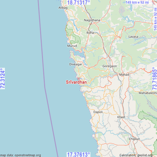
Srīvardhan GPS coordinates[2]
18° 2' 45.312" North, 73° 0' 55.872" East
| Map corner | latitude | longitude |
|---|---|---|
| Upper-left | 18.71317°, | 72.3124° |
| Center: | 18.04592°, | 73.01552° |
| Lower-right: | 17.37613°, | 73.71865° |
| Map W x H: | 148.7×148.7 km | = 92.4×92.4mi |
| max Lat: | 34.9274° ⇑71.7% North |
| Srīvardhan: | 18.04592° |
| min Lat: | ⇓28.3% South 8.09008° |
| min Long | Srīvardhan | max Long |
| 68.82655° | 73.01552° | 96.81° |
| W 5.4%⇐ | ⇒94.6% E |
Elevation
Elevation of Srīvardhan is 14 m = 46 ft, and this is 281.6 m = 924 ft below average elevation for this country.
| Max E: |
3681 m = 12077 ft | 92.8% |
| Avg. | 295.6 m = 970 ft | |
| Srīvardhan | 14 m = 46 ft | |
Min E: |
1 m = 3 ft | 7.2% |
See also: India elevation on elevation.city.
Geographical zone
Srīvardhan is located in North Torrid zone (between Equator and Tropic of Cancer). Distance of this Northern Tropic circle is 599.4 km =372.4 mi to North.| Distance of | km | miles | from Srīvardhan |
|---|---|---|---|
| North Pole | 8000.5 | 4971.3 | to North |
| Arctic Circle | 5394.7 | 3352.1 | to North |
| Tropic Cancer | 599.4 | 372.4 | to North |
| Equator | 2006.5 | 1246.8 | to South |


Nearby cities:
15 places around Srīvardhan: (largest is in red/bold)
• Alībāg
68.6 km =42.6 mi,  347°
347°
• Dābhol
53.6 km =33.3 mi,  161°
161°
• Goregaon
31.6 km =19.6 mi,  67°
67°
• Guhāgar
65.2 km =40.5 mi, 163°
• Harnai
27.2 km =16.9 mi, 161°
• Indāpur
37.6 km =23.4 mi,  41°
41°
• Jalgaon
38.7 km =24 mi,  151°
151°
• Khed
54.3 km =33.7 mi,  132°
132°
• Mahābaleshwar
67.6 km =42 mi,  143°
143°
• Mahād
42.6 km =26.5 mi,  84°
84°
• Mhasla
14.1 km =8.8 mi,  46°
46°
• Murud
31.9 km =19.8 mi, 349°
• Nāgothana
56.6 km =35.2 mi,  12°
12°
• Revadanda
57.2 km =35.5 mi, 350°
• Roha
44.8 km =27.8 mi, 14°
Sources, notices
• [Note1] Compared only with cities in India existing in our database
• [Src1] Map data: © OpenStreetMap contributors (CC-BY-SA)
• [Src2] Other city data from geonames.org with taken over terms of usage.
• [Src3] Geographical zone / Annual Mean Temperature by Robert A. Rohde @ Wikipedia
