Mahābaleshwar geodata
Mahābaleshwar (Maharashtra) is a populated place; located in India in Asia/Kolkata (GMT+5.5) time zone. With population of 13,598 people, there are 2603 cities with bigger population in this country. Compared to other cities in India, 73% of cities are located further ↑North; 93% of cities are located further →East and 60.9% of cities have lower elevation than Mahābaleshwar. Note1


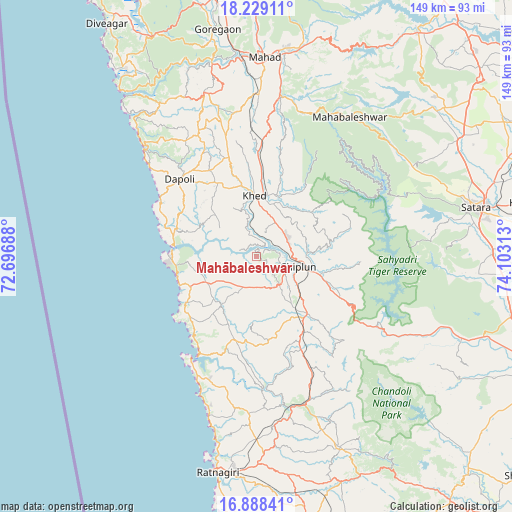
Mahābaleshwar GPS coordinates[2]
17° 33' 36" North, 73° 24' 0" East
| Map corner | latitude | longitude |
|---|---|---|
| Upper-left | 18.22911°, | 72.69688° |
| Center: | 17.56°, | 73.4° |
| Lower-right: | 16.88841°, | 74.10313° |
| Map W x H: | 149.1×149.1 km | = 92.6×92.6mi |
| max Lat: | 34.9274° ⇑73% North |
| Mahābaleshwar: | 17.56° |
| min Lat: | ⇓27% South 8.09008° |
| min Long | Mahābaleshwar | max Long |
| 68.82655° | 73.4° | 96.81° |
| W 7%⇐ | ⇒93% E |
Elevation
Elevation of Mahābaleshwar is 257 m = 843 ft, and this is 38.6 m = 127 ft below average elevation for this country.
| Max E: |
3681 m = 12077 ft | 39.1% |
| Avg. | 295.6 m = 970 ft | |
| Mahābaleshwar | 257 m = 843 ft | |
Min E: |
1 m = 3 ft | 60.9% |
See also: India elevation on elevation.city.
Geographical zone
Mahābaleshwar is located in North Torrid zone (between Equator and Tropic of Cancer). Distance of this Northern Tropic circle is 653.4 km =406 mi to North.| Distance of | km | miles | from Mahābaleshwar |
|---|---|---|---|
| North Pole | 8054.6 | 5004.9 | to North |
| Arctic Circle | 5448.7 | 3385.7 | to North |
| Tropic Cancer | 653.4 | 406 | to North |
| Equator | 1952.5 | 1213.2 | to South |


Nearby cities:
15 places around Mahābaleshwar: (largest is in red/bold)
• Chiplūn
12 km =7.5 mi,  104°
104°
• Dābhol
23.6 km =14.7 mi,  278°
278°
• Goregaon
67.1 km =41.7 mi,  350°
350°
• Guhāgar
23.5 km =14.6 mi,  248°
248°
• Harnai
42.7 km =26.5 mi,  311°
311°
• Jalgaon
29.9 km =18.6 mi, 312°
• Khed
17.7 km =11 mi,  358°
358°
• Koynanagar
42.8 km =26.6 mi,  114°
114°
• Mahād
58.2 km =36.2 mi,  1°
1°
• Mākhjan
34 km =21.1 mi,  161°
161°
• Pānchgani
58.7 km =36.5 mi,  46°
46°
• Pātan
57 km =35.4 mi, 111°
• Ratnagiri
63.9 km =39.7 mi,  188°
188°
• Satara
64.4 km =40 mi,  77°
77°
• Srīvardhan
67.6 km =42 mi,  323°
323°
Sources, notices
• [Note1] Compared only with cities in India existing in our database
• [Src1] Map data: © OpenStreetMap contributors (CC-BY-SA)
• [Src2] Other city data from geonames.org with taken over terms of usage.
• [Src3] Geographical zone / Annual Mean Temperature by Robert A. Rohde @ Wikipedia
