Mhasla geodata
Mhasla (Maharashtra) is a populated place; located in India in Asia/Kolkata (GMT+5.5) time zone. With population of 9,331 people, there are 3009 cities with bigger population in this country. Compared to other cities in India, 71.5% of cities are located further ↑North; 94.1% of cities are located further →East and 86.8% of cities have higher elevation than Mhasla. Note1


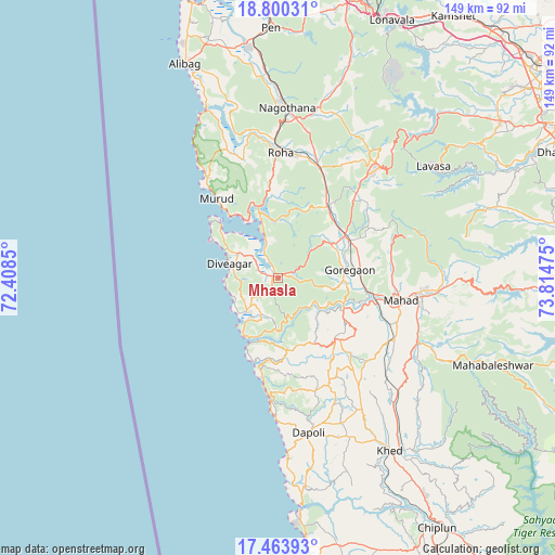
Mhasla GPS coordinates[2]
18° 8' 0.24" North, 73° 6' 41.832" East
| Map corner | latitude | longitude |
|---|---|---|
| Upper-left | 18.80031°, | 72.4085° |
| Center: | 18.1334°, | 73.11162° |
| Lower-right: | 17.46393°, | 73.81475° |
| Map W x H: | 148.6×148.6 km | = 92.3×92.3mi |
| max Lat: | 34.9274° ⇑71.5% North |
| Mhasla: | 18.1334° |
| min Lat: | ⇓28.5% South 8.09008° |
| min Long | Mhasla | max Long |
| 68.82655° | 73.11162° | 96.81° |
| W 5.9%⇐ | ⇒94.1% E |
Elevation
Elevation of Mhasla is 25 m = 82 ft, and this is 270.6 m = 888 ft below average elevation for this country.
| Max E: |
3681 m = 12077 ft | 86.8% |
| Avg. | 295.6 m = 970 ft | |
| Mhasla | 25 m = 82 ft | |
Min E: |
1 m = 3 ft | 13.2% |
See also: India elevation on elevation.city.
Geographical zone
Mhasla is located in North Torrid zone (between Equator and Tropic of Cancer). Distance of this Northern Tropic circle is 589.7 km =366.4 mi to North.| Distance of | km | miles | from Mhasla |
|---|---|---|---|
| North Pole | 7990.8 | 4965.3 | to North |
| Arctic Circle | 5384.9 | 3346 | to North |
| Tropic Cancer | 589.7 | 366.4 | to North |
| Equator | 2016.2 | 1252.8 | to South |


Nearby cities:
15 places around Mhasla: (largest is in red/bold)
• Alībāg
62.4 km =38.8 mi,  336°
336°
• Dābhol
60.9 km =37.8 mi,  173°
173°
• Goregaon
19.2 km =11.9 mi,  82°
82°
• Harnai
35.6 km =22.1 mi,  182°
182°
• Indāpur
23.6 km =14.7 mi,  38°
38°
• Jalgaon
44.5 km =27.7 mi, 169°
• Khed
55.1 km =34.2 mi,  146°
146°
• Mahābaleshwar
70.7 km =43.9 mi, 154°
• Mahād
32.7 km =20.3 mi,  99°
99°
• Murud
26.8 km =16.7 mi,  323°
323°
• Nāgothana
45.5 km =28.3 mi,  3°
3°
• Pen
67.2 km =41.8 mi,  358°
358°
• Revadanda
50.7 km =31.5 mi, 337°
• Roha
33.8 km =21 mi, 1°
• Srīvardhan
14.1 km =8.8 mi,  226°
226°
Sources, notices
• [Note1] Compared only with cities in India existing in our database
• [Src1] Map data: © OpenStreetMap contributors (CC-BY-SA)
• [Src2] Other city data from geonames.org with taken over terms of usage.
• [Src3] Geographical zone / Annual Mean Temperature by Robert A. Rohde @ Wikipedia
