Sāvda geodata
Sāvda (Maharashtra) is a populated place; located in India in Asia/Kolkata (GMT+5.5) time zone. With population of 19,903 people, there are 2050 cities with bigger population in this country. Compared to other cities in India, 61% of cities are located further ↑North; 74.7% of cities are located further →East and 54.5% of cities have lower elevation than Sāvda. Note1


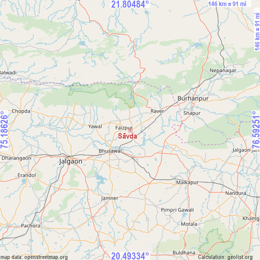
Sāvda GPS coordinates[2]
21° 9' 1.944" North, 75° 53' 21.768" East
| Map corner | latitude | longitude |
|---|---|---|
| Upper-left | 21.80484°, | 75.18626° |
| Center: | 21.15054°, | 75.88938° |
| Lower-right: | 20.49334°, | 76.59251° |
| Map W x H: | 145.8×145.8 km | = 90.6×90.6mi |
| max Lat: | 34.9274° ⇑61% North |
| Sāvda: | 21.15054° |
| min Lat: | ⇓39% South 8.09008° |
| min Long | Sāvda | max Long |
| 68.82655° | 75.88938° | 96.81° |
| W 25.3%⇐ | ⇒74.7% E |
Elevation
Elevation of Sāvda is 224 m = 735 ft, and this is 71.6 m = 235 ft below average elevation for this country.
| Max E: |
3681 m = 12077 ft | 45.5% |
| Avg. | 295.6 m = 970 ft | |
| Sāvda | 224 m = 735 ft | |
Min E: |
1 m = 3 ft | 54.5% |
See also: India elevation on elevation.city.
Geographical zone
Sāvda is located in North Torrid zone (between Equator and Tropic of Cancer). Distance of this Northern Tropic circle is 254.2 km =158 mi to North.| Distance of | km | miles | from Sāvda |
|---|---|---|---|
| North Pole | 7655.3 | 4756.8 | to North |
| Arctic Circle | 5049.5 | 3137.6 | to North |
| Tropic Cancer | 254.2 | 158 | to North |
| Equator | 2351.7 | 1461.3 | to South |


Nearby cities:
15 places around Sāvda: (largest is in red/bold)
• Bhusāval
16.1 km =10 mi,  222°
222°
• Burhānpur
39.5 km =24.5 mi,  63°
63°
• Chopda
62.1 km =38.6 mi,  279°
279°
• Dharangaon
65.7 km =40.8 mi,  256°
256°
• Erandol
63.7 km =39.6 mi,  246°
246°
• Faizpur
3.6 km =2.2 mi,  302°
302°
• Jalgaon
37.3 km =23.2 mi,  243°
243°
• Jalgaon Jamod
67.8 km =42.1 mi,  99°
99°
• Malkāpur
43.6 km =27.1 mi,  132°
132°
• Nepānagar
62.2 km =38.6 mi, 57°
• Rāver
18.6 km =11.6 mi,  54°
54°
• Shāhpur
36.2 km =22.5 mi,  74°
74°
• Soygaon
67.8 km =42.1 mi,  204°
204°
• Varangaon
14.9 km =9.3 mi,  171°
171°
• Yāval
20 km =12.4 mi, 275°
Sources, notices
• [Note1] Compared only with cities in India existing in our database
• [Src1] Map data: © OpenStreetMap contributors (CC-BY-SA)
• [Src2] Other city data from geonames.org with taken over terms of usage.
• [Src3] Geographical zone / Annual Mean Temperature by Robert A. Rohde @ Wikipedia
