Rāver geodata
Rāver (Maharashtra) is a populated place; located in India in Asia/Kolkata (GMT+5.5) time zone. With population of 26,635 people, there are 1603 cities with bigger population in this country. Compared to other cities in India, 60.4% of cities are located further ↑North; 73.4% of cities are located further →East and 60.5% of cities have lower elevation than Rāver. Note1


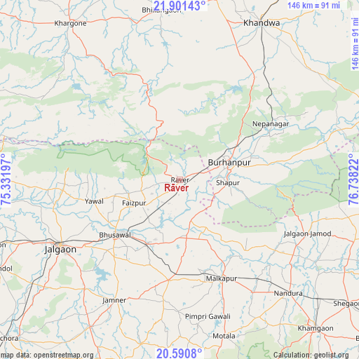
Rāver GPS coordinates[2]
21° 14' 51.252" North, 76° 2' 6.324" East
| Map corner | latitude | longitude |
|---|---|---|
| Upper-left | 21.90143°, | 75.33197° |
| Center: | 21.24757°, | 76.03509° |
| Lower-right: | 20.5908°, | 76.73822° |
| Map W x H: | 145.7×145.7 km | = 90.5×90.5mi |
| max Lat: | 34.9274° ⇑60.4% North |
| Rāver: | 21.24757° |
| min Lat: | ⇓39.6% South 8.09008° |
| min Long | Rāver | max Long |
| 68.82655° | 76.03509° | 96.81° |
| W 26.6%⇐ | ⇒73.4% E |
Elevation
Elevation of Rāver is 255 m = 837 ft, and this is 40.6 m = 133 ft below average elevation for this country.
| Max E: |
3681 m = 12077 ft | 39.5% |
| Avg. | 295.6 m = 970 ft | |
| Rāver | 255 m = 837 ft | |
Min E: |
1 m = 3 ft | 60.5% |
See also: India elevation on elevation.city.
Geographical zone
Rāver is located in North Torrid zone (between Equator and Tropic of Cancer). Distance of this Northern Tropic circle is 243.4 km =151.2 mi to North.| Distance of | km | miles | from Rāver |
|---|---|---|---|
| North Pole | 7644.6 | 4750.1 | to North |
| Arctic Circle | 5038.7 | 3130.9 | to North |
| Tropic Cancer | 243.4 | 151.2 | to North |
| Equator | 2362.5 | 1468 | to South |


Nearby cities:
15 places around Rāver: (largest is in red/bold)
• Bhikangaon
69.3 km =43.1 mi,  353°
353°
• Bhusāval
34.4 km =21.4 mi,  228°
228°
• Burhānpur
21.3 km =13.2 mi,  71°
71°
• Faizpur
20.2 km =12.6 mi,  243°
243°
• Jalgaon
55.7 km =34.6 mi, 240°
• Jalgaon Jamod
56.2 km =34.9 mi,  112°
112°
• Khandwa
72 km =44.7 mi,  26°
26°
• Malkāpur
43.7 km =27.2 mi,  157°
157°
• Nepānagar
43.6 km =27.1 mi,  58°
58°
• Nāndūra Buzurg
63.6 km =39.5 mi,  136°
136°
• Pandhāna
53.8 km =33.4 mi,  21°
21°
• Shāhpur
19.8 km =12.3 mi,  93°
93°
• Sāvda
18.6 km =11.6 mi, 234°
• Varangaon
28.6 km =17.8 mi,  206°
206°
• Yāval
36.1 km =22.4 mi,  255°
255°
Sources, notices
• [Note1] Compared only with cities in India existing in our database
• [Src1] Map data: © OpenStreetMap contributors (CC-BY-SA)
• [Src2] Other city data from geonames.org with taken over terms of usage.
• [Src3] Geographical zone / Annual Mean Temperature by Robert A. Rohde @ Wikipedia
