Burhānpur geodata
Burhānpur (Madhya Pradesh) is a populated place; located in India in Asia/Kolkata (GMT+5.5) time zone. With population of 202,695 people, there are 207 cities with bigger population in this country. Compared to other cities in India, 60% of cities are located further ↑North; 71.3% of cities are located further →East and 60.1% of cities have lower elevation than Burhānpur. Note1


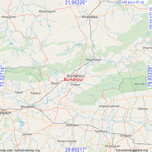
Burhānpur GPS coordinates[2]
21° 18' 31.248" North, 76° 13' 48.936" East
| Map corner | latitude | longitude |
|---|---|---|
| Upper-left | 21.96226°, | 75.52714° |
| Center: | 21.30868°, | 76.23026° |
| Lower-right: | 20.65217°, | 76.93339° |
| Map W x H: | 145.7×145.7 km | = 90.5×90.5mi |
| max Lat: | 34.9274° ⇑60% North |
| Burhānpur: | 21.30868° |
| min Lat: | ⇓40% South 8.09008° |
| min Long | Burhānpur | max Long |
| 68.82655° | 76.23026° | 96.81° |
| W 28.7%⇐ | ⇒71.3% E |
Elevation
Elevation of Burhānpur is 251 m = 823 ft, and this is 44.6 m = 146 ft below average elevation for this country.
| Max E: |
3681 m = 12077 ft | 39.9% |
| Avg. | 295.6 m = 970 ft | |
| Burhānpur | 251 m = 823 ft | |
Min E: |
1 m = 3 ft | 60.1% |
See also: Burhānpur elevation on elevation.city.
Geographical zone
Burhānpur is located in North Torrid zone (between Equator and Tropic of Cancer). Distance of this Northern Tropic circle is 236.6 km =147 mi to North.| Distance of | km | miles | from Burhānpur |
|---|---|---|---|
| North Pole | 7637.8 | 4745.9 | to North |
| Arctic Circle | 5031.9 | 3126.7 | to North |
| Tropic Cancer | 236.6 | 147 | to North |
| Equator | 2369.3 | 1472.2 | to South |


Nearby cities:
15 places around Burhānpur: (largest is in red/bold)
• Bhikangaon
68 km =42.3 mi,  336°
336°
• Bhusāval
54.8 km =34.1 mi,  237°
237°
• Faizpur
41.4 km =25.7 mi,  247°
247°
• Jalgaon Jamod
42.6 km =26.5 mi,  132°
132°
• Khandwa
58.7 km =36.5 mi,  12°
12°
• Malkāpur
47.2 km =29.3 mi,  183°
183°
• Nepānagar
23.4 km =14.5 mi,  46°
46°
• Nāndūra Buzurg
57.9 km =36 mi,  155°
155°
• Pandhāna
43.3 km =26.9 mi,  359°
359°
• Rāver
21.3 km =13.2 mi, 251°
• Shāhpur
7.9 km =4.9 mi, 183°
• Sāvda
39.5 km =24.5 mi, 243°
• Telhāra
70.5 km =43.8 mi,  116°
116°
• Varangaon
46.3 km =28.8 mi,  225°
225°
• Yāval
57.4 km =35.7 mi, 254°
Sources, notices
• [Note1] Compared only with cities in India existing in our database
• [Src1] Map data: © OpenStreetMap contributors (CC-BY-SA)
• [Src2] Other city data from geonames.org with taken over terms of usage.
• [Src3] Geographical zone / Annual Mean Temperature by Robert A. Rohde @ Wikipedia
