Faizpur geodata
Faizpur (Maharashtra) is a populated place; located in India in Asia/Kolkata (GMT+5.5) time zone. With population of 24,534 people, there are 1736 cities with bigger population in this country. Compared to other cities in India, 60.9% of cities are located further ↑North; 75.1% of cities are located further →East and 55.1% of cities have lower elevation than Faizpur. Note1


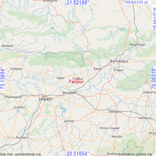
Faizpur GPS coordinates[2]
21° 10' 3.576" North, 75° 51' 36.216" East
| Map corner | latitude | longitude |
|---|---|---|
| Upper-left | 21.82188°, | 75.15694° |
| Center: | 21.16766°, | 75.86006° |
| Lower-right: | 20.51054°, | 76.56319° |
| Map W x H: | 145.8×145.8 km | = 90.6×90.6mi |
| max Lat: | 34.9274° ⇑60.9% North |
| Faizpur: | 21.16766° |
| min Lat: | ⇓39.1% South 8.09008° |
| min Long | Faizpur | max Long |
| 68.82655° | 75.86006° | 96.81° |
| W 24.9%⇐ | ⇒75.1% E |
Elevation
Elevation of Faizpur is 227 m = 745 ft, and this is 68.6 m = 225 ft below average elevation for this country.
| Max E: |
3681 m = 12077 ft | 44.9% |
| Avg. | 295.6 m = 970 ft | |
| Faizpur | 227 m = 745 ft | |
Min E: |
1 m = 3 ft | 55.1% |
See also: India elevation on elevation.city.
Geographical zone
Faizpur is located in North Torrid zone (between Equator and Tropic of Cancer). Distance of this Northern Tropic circle is 252.3 km =156.8 mi to North.| Distance of | km | miles | from Faizpur |
|---|---|---|---|
| North Pole | 7653.4 | 4755.6 | to North |
| Arctic Circle | 5047.6 | 3136.4 | to North |
| Tropic Cancer | 252.3 | 156.8 | to North |
| Equator | 2353.6 | 1462.5 | to South |


Nearby cities:
15 places around Faizpur: (largest is in red/bold)
• Bhusāval
15.8 km =9.8 mi,  209°
209°
• Burhānpur
41.4 km =25.7 mi,  67°
67°
• Chopda
58.8 km =36.5 mi,  278°
278°
• Dharangaon
63.2 km =39.3 mi,  254°
254°
• Erandol
61.7 km =38.3 mi,  243°
243°
• Jalgaon
35.6 km =22.1 mi, 239°
• Malkāpur
47.2 km =29.3 mi,  131°
131°
• Nepānagar
63.7 km =39.6 mi,  60°
60°
• Pandhāna
70 km =43.5 mi,  32°
32°
• Rāver
20.2 km =12.6 mi, 63°
• Shāhpur
38.7 km =24 mi,  78°
78°
• Soygaon
68.4 km =42.5 mi,  201°
201°
• Sāvda
3.6 km =2.2 mi,  122°
122°
• Varangaon
17.5 km =10.9 mi,  162°
162°
• Yāval
16.8 km =10.4 mi,  270°
270°
Sources, notices
• [Note1] Compared only with cities in India existing in our database
• [Src1] Map data: © OpenStreetMap contributors (CC-BY-SA)
• [Src2] Other city data from geonames.org with taken over terms of usage.
• [Src3] Geographical zone / Annual Mean Temperature by Robert A. Rohde @ Wikipedia
