Rānībennur geodata
Rānībennur (Karnataka) is a populated place; located in India in Asia/Kolkata (GMT+5.5) time zone. With population of 99,105 people, there are 445 cities with bigger population in this country. Compared to other cities in India, 82.2% of cities are located further ↑North; 77.3% of cities are located further →East and 87.1% of cities have lower elevation than Rānībennur. Note1


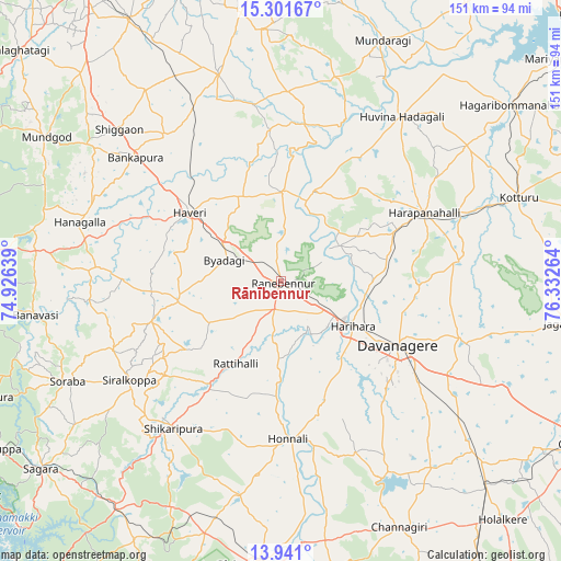
Rānībennur GPS coordinates[2]
14° 37' 20.604" North, 75° 37' 46.236" East
| Map corner | latitude | longitude |
|---|---|---|
| Upper-left | 15.30167°, | 74.92639° |
| Center: | 14.62239°, | 75.62951° |
| Lower-right: | 13.941°, | 76.33264° |
| Map W x H: | 151.3×151.3 km | = 94×94mi |
| max Lat: | 34.9274° ⇑82.2% North |
| Rānībennur: | 14.62239° |
| min Lat: | ⇓17.8% South 8.09008° |
| min Long | Rānībennur | max Long |
| 68.82655° | 75.62951° | 96.81° |
| W 22.7%⇐ | ⇒77.3% E |
Elevation
Elevation of Rānībennur is 579 m = 1900 ft, and this is 283.4 m = 930 ft above average elevation for this country.
| Max E: |
3681 m = 12077 ft | 12.9% |
| Rānībennur | 579 m 1900 ft | |
| Avg. | 295.6 m = 970 ft | |
Min E: |
1 m = 3 ft | 87.1% |
See also: Rānībennur elevation on elevation.city.
Geographical zone
Rānībennur is located in North Torrid zone (between Equator and Tropic of Cancer). Distance of this Northern Tropic circle is 980.1 km =609 mi to North.| Distance of | km | miles | from Rānībennur |
|---|---|---|---|
| North Pole | 8381.2 | 5207.8 | to North |
| Arctic Circle | 5775.3 | 3588.6 | to North |
| Tropic Cancer | 980.1 | 609 | to North |
| Equator | 1625.9 | 1010.3 | to South |


Nearby cities:
15 places around Rānībennur: (largest is in red/bold)
• Byādgi
16.4 km =10.2 mi,  290°
290°
• Davangere
36.4 km =22.6 mi,  118°
118°
• Hadagalli
54.9 km =34.1 mi,  36°
36°
• Harihar
22.7 km =14.1 mi, 122°
• Harpanahalli
42.8 km =26.6 mi,  64°
64°
• Hirekerūr
31.3 km =19.4 mi,  233°
233°
• Honnāli
42.6 km =26.5 mi,  177°
177°
• Hāngal
56.6 km =35.2 mi, 286°
• Hāveri
30.8 km =19.1 mi,  308°
308°
• Lakshmeshwar
58.7 km =36.5 mi,  342°
342°
• Māyakonda
61.3 km =38.1 mi,  127°
127°
• Nyāmti
53 km =32.9 mi,  186°
186°
• Savanūr
50.1 km =31.1 mi,  321°
321°
• Shiggaon
59.7 km =37.1 mi, 313°
• Shikārpur
49 km =30.4 mi,  216°
216°
Sources, notices
• [Note1] Compared only with cities in India existing in our database
• [Src1] Map data: © OpenStreetMap contributors (CC-BY-SA)
• [Src2] Other city data from geonames.org with taken over terms of usage.
• [Src3] Geographical zone / Annual Mean Temperature by Robert A. Rohde @ Wikipedia
