Pūnāhāna geodata
Pūnāhāna (Haryana) is a populated place; located in India in Asia/Kolkata (GMT+5.5) time zone. With population of 15,332 people, there are 2432 cities with bigger population in this country. Compared to other cities in India, 83.7% of cities are located further ↓South; 61% of cities are located further →East and 51.7% of cities have higher elevation than Pūnāhāna. Note1


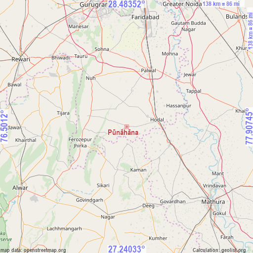
Pūnāhāna GPS coordinates[2]
27° 51' 49.356" North, 77° 12' 15.552" East
| Map corner | latitude | longitude |
|---|---|---|
| Upper-left | 28.48352°, | 76.5012° |
| Center: | 27.86371°, | 77.20432° |
| Lower-right: | 27.24033°, | 77.90745° |
| Map W x H: | 138.2×138.2 km | = 85.9×85.9mi |
| max Lat: | 34.9274° ⇑16.3% North |
| Pūnāhāna: | 27.86371° |
| min Lat: | ⇓83.7% South 8.09008° |
| min Long | Pūnāhāna | max Long |
| 68.82655° | 77.20432° | 96.81° |
| W 39%⇐ | ⇒61% E |
Elevation
Elevation of Pūnāhāna is 193 m = 633 ft, and this is 102.6 m = 337 ft below average elevation for this country.
| Max E: |
3681 m = 12077 ft | 51.7% |
| Avg. | 295.6 m = 970 ft | |
| Pūnāhāna | 193 m = 633 ft | |
Min E: |
1 m = 3 ft | 48.3% |
See also: India elevation on elevation.city.
Geographical zone
Pūnāhāna is located in North temperate zone (between Tropic of Cancer and the Arctic Circle). Distance of this Northern Tropic circle is 492.2 km =305.8 mi to South.| Distance of | km | miles | from Pūnāhāna |
|---|---|---|---|
| North Pole | 6908.9 | 4293 | to North |
| Arctic Circle | 4303 | 2673.8 | to North |
| Tropic Cancer | 492.2 | 305.8 | to South |
| Equator | 3098.2 | 1925.1 | to South |


Nearby cities:
15 places around Pūnāhāna: (largest is in red/bold)
• Barsāna
29.4 km =18.3 mi,  144°
144°
• Chhāta
33.7 km =20.9 mi,  117°
117°
• Dīg
45.2 km =28.1 mi,  164°
164°
• Fīrozpur Jhirka
26.8 km =16.7 mi,  251°
251°
• Govindgarh
44.8 km =27.8 mi,  206°
206°
• Hasanpur
30.9 km =19.2 mi,  67°
67°
• Hodal
16.3 km =10.1 mi,  78°
78°
• Jewar
45 km =28 mi,  50°
50°
• Kosi
24.1 km =15 mi,  108°
108°
• Kāman
23.8 km =14.8 mi, 164°
• Nandgaon
24.7 km =15.3 mi,  133°
133°
• Nūh
33.2 km =20.6 mi,  323°
323°
• Palwal
33.4 km =20.8 mi,  20°
20°
• Sohna
44.8 km =27.8 mi,  342°
342°
• Tijāra
35.2 km =21.9 mi,  282°
282°
Sources, notices
• [Note1] Compared only with cities in India existing in our database
• [Src1] Map data: © OpenStreetMap contributors (CC-BY-SA)
• [Src2] Other city data from geonames.org with taken over terms of usage.
• [Src3] Geographical zone / Annual Mean Temperature by Robert A. Rohde @ Wikipedia
