Pattukkottai geodata
Pattukkottai (Tamil Nadu) is a populated place; located in India in Asia/Kolkata (GMT+5.5) time zone. With population of 67,982 people, there are 641 cities with bigger population in this country. Compared to other cities in India, 95.2% of cities are located further ↑North; 62% of cities are located further ←West and 86% of cities have higher elevation than Pattukkottai. Note1


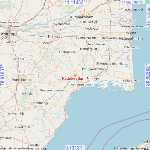
Pattukkottai GPS coordinates[2]
10° 25' 24.888" North, 79° 19' 10.164" East
| Map corner | latitude | longitude |
|---|---|---|
| Upper-left | 11.11432°, | 78.61637° |
| Center: | 10.42358°, | 79.31949° |
| Lower-right: | 9.73131°, | 80.02262° |
| Map W x H: | 153.8×153.8 km | = 95.6×95.6mi |
| max Lat: | 34.9274° ⇑95.2% North |
| Pattukkottai: | 10.42358° |
| min Lat: | ⇓4.8% South 8.09008° |
| min Long | Pattukkottai | max Long |
| 68.82655° | 79.31949° | 96.81° |
| W 62%⇐ | ⇒38% E |
Elevation
Elevation of Pattukkottai is 27 m = 89 ft, and this is 268.6 m = 881 ft below average elevation for this country.
| Max E: |
3681 m = 12077 ft | 86% |
| Avg. | 295.6 m = 970 ft | |
| Pattukkottai | 27 m = 89 ft | |
Min E: |
1 m = 3 ft | 14% |
See also: Pattukkottai elevation on elevation.city.
Geographical zone
Pattukkottai is located in North Torrid zone (between Equator and Tropic of Cancer). Distance of Equator is 1159 km =720.2 mi to South.| Distance of | km | miles | from Pattukkottai |
|---|---|---|---|
| North Pole | 8848.1 | 5498 | to North |
| Arctic Circle | 6242.2 | 3878.7 | to North |
| Tropic Cancer | 1446.9 | 899.1 | to North |
| Equator | 1159 | 720.2 | to South |


Nearby cities:
15 places around Pattukkottai: (largest is in red/bold)
• Adirampattinam
11.3 km =7 mi,  144°
144°
• Ammāpettai
41.3 km =25.7 mi,  0°
0°
• Arantāngi
45.5 km =28.3 mi,  232°
232°
• Arimalam
51.2 km =31.8 mi,  248°
248°
• Karambakkudi
19.9 km =12.4 mi,  281°
281°
• Koothanallur
39.3 km =24.4 mi,  33°
33°
• Koradāchcheri
42.9 km =26.7 mi, 26°
• Madukkūr
10.8 km =6.7 mi,  53°
53°
• Mannargudi
30.6 km =19 mi, 27°
• Muttupet
19.3 km =12 mi,  99°
99°
• Needamangalam
40.4 km =25.1 mi,  15°
15°
• Peravurani
19.6 km =12.2 mi,  221°
221°
• Tanjore
44.8 km =27.8 mi,  333°
333°
• Vallam
43.5 km =27 mi,  319°
319°
• Ālangudi
37.3 km =23.2 mi,  259°
259°
Sources, notices
• [Note1] Compared only with cities in India existing in our database
• [Src1] Map data: © OpenStreetMap contributors (CC-BY-SA)
• [Src2] Other city data from geonames.org with taken over terms of usage.
• [Src3] Geographical zone / Annual Mean Temperature by Robert A. Rohde @ Wikipedia
