Madukkūr geodata
Madukkūr (Tamil Nadu) is a populated place; located in India in Asia/Kolkata (GMT+5.5) time zone. With population of 15,631 people, there are 2404 cities with bigger population in this country. Compared to other cities in India, 95% of cities are located further ↑North; 62.6% of cities are located further ←West and 87.2% of cities have higher elevation than Madukkūr. Note1


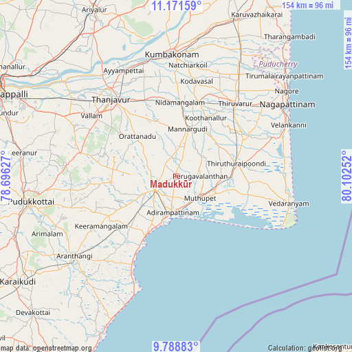
Madukkūr GPS coordinates[2]
10° 28' 51.528" North, 79° 23' 57.804" East
| Map corner | latitude | longitude |
|---|---|---|
| Upper-left | 11.17159°, | 78.69627° |
| Center: | 10.48098°, | 79.39939° |
| Lower-right: | 9.78883°, | 80.10252° |
| Map W x H: | 153.7×153.8 km | = 95.5×95.6mi |
| max Lat: | 34.9274° ⇑95% North |
| Madukkūr: | 10.48098° |
| min Lat: | ⇓5% South 8.09008° |
| min Long | Madukkūr | max Long |
| 68.82655° | 79.39939° | 96.81° |
| W 62.6%⇐ | ⇒37.4% E |
Elevation
Elevation of Madukkūr is 24 m = 79 ft, and this is 271.6 m = 891 ft below average elevation for this country.
| Max E: |
3681 m = 12077 ft | 87.2% |
| Avg. | 295.6 m = 970 ft | |
| Madukkūr | 24 m = 79 ft | |
Min E: |
1 m = 3 ft | 12.8% |
See also: India elevation on elevation.city.
Geographical zone
Madukkūr is located in North Torrid zone (between Equator and Tropic of Cancer). Distance of Equator is 1165.4 km =724.1 mi to South.| Distance of | km | miles | from Madukkūr |
|---|---|---|---|
| North Pole | 8841.7 | 5494 | to North |
| Arctic Circle | 6235.8 | 3874.7 | to North |
| Tropic Cancer | 1440.5 | 895.1 | to North |
| Equator | 1165.4 | 724.1 | to South |


Nearby cities:
15 places around Madukkūr: (largest is in red/bold)
• Adirampattinam
15.8 km =9.8 mi,  188°
188°
• Ammāpettai
36 km =22.4 mi,  346°
346°
• Karambakkudi
28.4 km =17.6 mi,  264°
264°
• Koothanallur
29.5 km =18.3 mi,  25°
25°
• Koradāchcheri
33.7 km =20.9 mi,  17°
17°
• Mannargudi
21.3 km =13.2 mi, 15°
• Muttupet
14 km =8.7 mi,  132°
132°
• Needamangalam
32.6 km =20.3 mi,  3°
3°
• Pattukkottai
10.8 km =6.7 mi,  233°
233°
• Peravurani
30.3 km =18.8 mi, 225°
• Tanjore
44.2 km =27.5 mi,  319°
319°
• Thiruvarur
41.5 km =25.8 mi,  38°
38°
• Valangaiman
45.5 km =28.3 mi,  359°
359°
• Vallam
45.6 km =28.3 mi,  305°
305°
• Ālangudi
47.3 km =29.4 mi,  253°
253°
Sources, notices
• [Note1] Compared only with cities in India existing in our database
• [Src1] Map data: © OpenStreetMap contributors (CC-BY-SA)
• [Src2] Other city data from geonames.org with taken over terms of usage.
• [Src3] Geographical zone / Annual Mean Temperature by Robert A. Rohde @ Wikipedia
