Nongpoh geodata
Nongpoh (Meghalaya) is a populated place; located in India in Asia/Kolkata (GMT+5.5) time zone. With population of 14,387 people, there are 2523 cities with bigger population in this country. Compared to other cities in India, 69.7% of cities are located further ↓South; 96.8% of cities are located further ←West and 84.7% of cities have lower elevation than Nongpoh. Note1


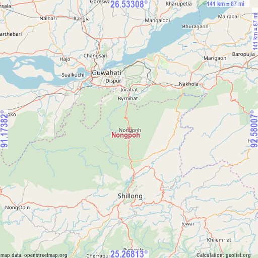
Nongpoh GPS coordinates[2]
25° 54' 8.28" North, 91° 52' 36.984" East
| Map corner | latitude | longitude |
|---|---|---|
| Upper-left | 26.53308°, | 91.17382° |
| Center: | 25.9023°, | 91.87694° |
| Lower-right: | 25.26813°, | 92.58007° |
| Map W x H: | 140.6×140.7 km | = 87.4×87.4mi |
| max Lat: | 34.9274° ⇑30.3% North |
| Nongpoh: | 25.9023° |
| min Lat: | ⇓69.7% South 8.09008° |
| min Long | Nongpoh | max Long |
| 68.82655° | 91.87694° | 96.81° |
| W 96.8%⇐ | ⇒3.2% E |
Elevation
Elevation of Nongpoh is 547 m = 1795 ft, and this is 251.4 m = 825 ft above average elevation for this country.
| Max E: |
3681 m = 12077 ft | 15.3% |
| Nongpoh | 547 m 1795 ft | |
| Avg. | 295.6 m = 970 ft | |
Min E: |
1 m = 3 ft | 84.7% |
See also: India elevation on elevation.city.
Geographical zone
Nongpoh is located in North temperate zone (between Tropic of Cancer and the Arctic Circle). Distance of this Northern Tropic circle is 274.1 km =170.3 mi to South.| Distance of | km | miles | from Nongpoh |
|---|---|---|---|
| North Pole | 7127 | 4428.5 | to North |
| Arctic Circle | 4521.1 | 2809.3 | to North |
| Tropic Cancer | 274.1 | 170.3 | to South |
| Equator | 2880.1 | 1789.6 | to South |


Nearby cities:
15 places around Nongpoh: (largest is in red/bold)
• Cherrapunji
69.3 km =43.1 mi,  195°
195°
• Dispur
27 km =16.8 mi,  343°
343°
• Guwahati
34 km =21.1 mi, 337°
• Hamren
74 km =46 mi,  87°
87°
• Hājo
51.8 km =32.2 mi,  317°
317°
• Khārupatia
73.6 km =45.7 mi,  21°
21°
• Mairang
44.9 km =27.9 mi,  212°
212°
• Mangaldai
61.9 km =38.5 mi,  14°
14°
• Morigaon
60.8 km =37.8 mi,  50°
50°
• North Guwāhāti
36.4 km =22.6 mi,  334°
334°
• Palāsbāri
41.7 km =25.9 mi,  306°
306°
• Rahā
73.7 km =45.8 mi,  60°
60°
• Rangia
66.3 km =41.2 mi, 336°
• Shillong
37.1 km =23.1 mi,  179°
179°
• Soalkuchi
42.5 km =26.4 mi, 314°
Sources, notices
• [Note1] Compared only with cities in India existing in our database
• [Src1] Map data: © OpenStreetMap contributors (CC-BY-SA)
• [Src2] Other city data from geonames.org with taken over terms of usage.
• [Src3] Geographical zone / Annual Mean Temperature by Robert A. Rohde @ Wikipedia
