Mallasamudram geodata
Mallasamudram (Tamil Nadu) is a populated place; located in India in Asia/Kolkata (GMT+5.5) time zone. With population of 18,820 people, there are 2143 cities with bigger population in this country. Compared to other cities in India, 91.3% of cities are located further ↑North; 51.1% of cities are located further →East and 53.6% of cities have lower elevation than Mallasamudram. Note1


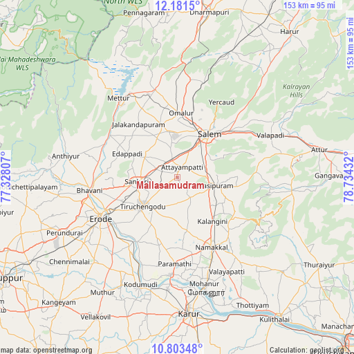
Mallasamudram GPS coordinates[2]
11° 29' 35.988" North, 78° 1' 52.284" East
| Map corner | latitude | longitude |
|---|---|---|
| Upper-left | 12.1815°, | 77.32807° |
| Center: | 11.49333°, | 78.03119° |
| Lower-right: | 10.80348°, | 78.73432° |
| Map W x H: | 153.2×153.2 km | = 95.2×95.2mi |
| max Lat: | 34.9274° ⇑91.3% North |
| Mallasamudram: | 11.49333° |
| min Lat: | ⇓8.7% South 8.09008° |
| min Long | Mallasamudram | max Long |
| 68.82655° | 78.03119° | 96.81° |
| W 48.9%⇐ | ⇒51.1% E |
Elevation
Elevation of Mallasamudram is 220 m = 722 ft, and this is 75.6 m = 248 ft below average elevation for this country.
| Max E: |
3681 m = 12077 ft | 46.4% |
| Avg. | 295.6 m = 970 ft | |
| Mallasamudram | 220 m = 722 ft | |
Min E: |
1 m = 3 ft | 53.6% |
See also: India elevation on elevation.city.
Geographical zone
Mallasamudram is located in North Torrid zone (between Equator and Tropic of Cancer). Distance of Equator is 1277.9 km =794.1 mi to South.| Distance of | km | miles | from Mallasamudram |
|---|---|---|---|
| North Pole | 8729.1 | 5424 | to North |
| Arctic Circle | 6123.2 | 3804.8 | to North |
| Tropic Cancer | 1328 | 825.2 | to North |
| Equator | 1277.9 | 794.1 | to South |


Nearby cities:
15 places around Mallasamudram: (largest is in red/bold)
• Ammāpettai
34.4 km =21.4 mi,  294°
294°
• Idappadi
23.4 km =14.5 mi,  296°
296°
• Ilampillai
12.9 km =8 mi,  348°
348°
• Jalakandapuram
28.5 km =17.7 mi,  322°
322°
• Konganāpuram
16.7 km =10.4 mi, 301°
• Māllūr
13.2 km =8.2 mi,  64°
64°
• Nangavalli
33.5 km =20.8 mi,  332°
332°
• Nāmagiripettai
26.2 km =16.3 mi,  99°
99°
• Nāmakkal
33.6 km =20.9 mi,  154°
154°
• Omalur
27.6 km =17.1 mi,  3°
3°
• Rasipuram
17.3 km =10.7 mi, 102°
• Salem
22.4 km =13.9 mi,  37°
37°
• Tiruchengode
19.5 km =12.1 mi,  229°
229°
• Tāramangalam
23.3 km =14.5 mi,  343°
343°
• Āttayyāmpatti
5 km =3.1 mi,  29°
29°
Sources, notices
• [Note1] Compared only with cities in India existing in our database
• [Src1] Map data: © OpenStreetMap contributors (CC-BY-SA)
• [Src2] Other city data from geonames.org with taken over terms of usage.
• [Src3] Geographical zone / Annual Mean Temperature by Robert A. Rohde @ Wikipedia
