Majītha geodata
Majītha (Punjab) is a populated place; located in India in Asia/Kolkata (GMT+5.5) time zone. With population of 13,900 people, there are 2573 cities with bigger population in this country. Compared to other cities in India, 97.4% of cities are located further ↓South; 83.1% of cities are located further →East and 58.3% of cities have lower elevation than Majītha. Note1


Majītha GPS coordinates[2]
31° 45' 25.596" North, 74° 57' 32.076" East
| Map corner | latitude | longitude |
|---|---|---|
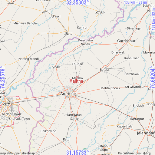
| Upper-left | 32.35303°, | 74.25579° |
| Center: | 31.75711°, | 74.95891° |
| Lower-right: | 31.15733°, | 75.66204° |
| Map W x H: | 132.9×133 km | = 82.6×82.6mi |
| max Lat: | 34.9274° ⇑2.6% North |
| Majītha: | 31.75711° |
| min Lat: | ⇓97.4% South 8.09008° |
| min Long | Majītha | max Long |
| 68.82655° | 74.95891° | 96.81° |
| W 16.9%⇐ | ⇒83.1% E |
Elevation
Elevation of Majītha is 241 m = 791 ft, and this is 54.6 m = 179 ft below average elevation for this country.
| Max E: |
3681 m = 12077 ft | 41.7% |
| Avg. | 295.6 m = 970 ft | |
| Majītha | 241 m = 791 ft | |
Min E: |
1 m = 3 ft | 58.3% |
See also: India elevation on elevation.city.
Geographical zone
Majītha is located in North temperate zone (between Tropic of Cancer and the Arctic Circle). Distance of this Northern Tropic circle is 925.1 km =574.8 mi to South.| Distance of | km | miles | from Majītha |
|---|---|---|---|
| North Pole | 6476 | 4024 | to North |
| Arctic Circle | 3870.1 | 2404.8 | to North |
| Tropic Cancer | 925.1 | 574.8 | to South |
| Equator | 3531.1 | 2194.1 | to South |


Nearby cities:
15 places around Majītha: (largest is in red/bold)
• Ajnāla
20.9 km =13 mi,  297°
297°
• Amritsar
16.9 km =10.5 mi,  207°
207°
• Batāla
23.8 km =14.8 mi,  75°
75°
• Begowāl
55.6 km =34.5 mi,  106°
106°
• Derā Nānak
31.8 km =19.8 mi,  11°
11°
• Dhilwan
45.5 km =28.3 mi,  126°
126°
• Dhāriwāl
41 km =25.5 mi,  57°
57°
• Fatehgarh Chūriān
11.9 km =7.4 mi,  358°
358°
• Jandiāla Gurū
22.7 km =14.1 mi,  163°
163°
• Kalanaur
33.7 km =20.9 mi,  32°
32°
• Patti
53.8 km =33.4 mi,  190°
190°
• Qādiān
40.1 km =24.9 mi, 79°
• Rāja Sānsi
15.5 km =9.6 mi,  254°
254°
• Rām Dās
23.9 km =14.9 mi,  348°
348°
• Tarn Tāran
34.1 km =21.2 mi,  184°
184°
Sources, notices
• [Note1] Compared only with cities in India existing in our database
• [Src1] Map data: © OpenStreetMap contributors (CC-BY-SA)
• [Src2] Other city data from geonames.org with taken over terms of usage.
• [Src3] Geographical zone / Annual Mean Temperature by Robert A. Rohde @ Wikipedia
