Batāla geodata
Batāla (Punjab) is a populated place; located in India in Asia/Kolkata (GMT+5.5) time zone. With population of 145,468 people, there are 302 cities with bigger population in this country. Compared to other cities in India, 97.5% of cities are located further ↓South; 80.9% of cities are located further →East and 61% of cities have lower elevation than Batāla. Note1


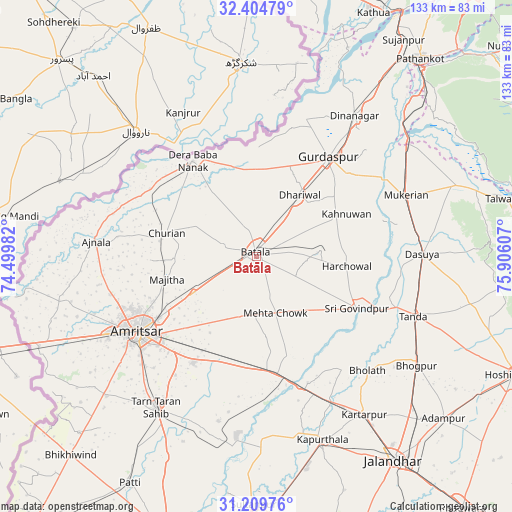
Batāla GPS coordinates[2]
31° 48' 33.156" North, 75° 12' 10.584" East
| Map corner | latitude | longitude |
|---|---|---|
| Upper-left | 32.40479°, | 74.49982° |
| Center: | 31.80921°, | 75.20294° |
| Lower-right: | 31.20976°, | 75.90607° |
| Map W x H: | 132.9×132.9 km | = 82.6×82.6mi |
| max Lat: | 34.9274° ⇑2.5% North |
| Batāla: | 31.80921° |
| min Lat: | ⇓97.5% South 8.09008° |
| min Long | Batāla | max Long |
| 68.82655° | 75.20294° | 96.81° |
| W 19.1%⇐ | ⇒80.9% E |
Elevation
Elevation of Batāla is 258 m = 846 ft, and this is 37.6 m = 123 ft below average elevation for this country.
| Max E: |
3681 m = 12077 ft | 39% |
| Avg. | 295.6 m = 970 ft | |
| Batāla | 258 m = 846 ft | |
Min E: |
1 m = 3 ft | 61% |
See also: Batāla elevation on elevation.city.
Geographical zone
Batāla is located in North temperate zone (between Tropic of Cancer and the Arctic Circle). Distance of this Northern Tropic circle is 930.9 km =578.4 mi to South.| Distance of | km | miles | from Batāla |
|---|---|---|---|
| North Pole | 6470.2 | 4020.4 | to North |
| Arctic Circle | 3864.3 | 2401.2 | to North |
| Tropic Cancer | 930.9 | 578.4 | to South |
| Equator | 3536.9 | 2197.7 | to South |


Nearby cities:
15 places around Batāla: (largest is in red/bold)
• Ajnāla
41.8 km =26 mi,  275°
275°
• Amritsar
37.3 km =23.2 mi,  236°
236°
• Begowāl
37.3 km =23.2 mi,  126°
126°
• Bhulath Gharbi
41.3 km =25.7 mi,  135°
135°
• Derā Nānak
30.3 km =18.8 mi,  326°
326°
• Dhilwan
35.5 km =22.1 mi,  157°
157°
• Dhāriwāl
19.9 km =12.4 mi,  34°
34°
• Fatehgarh Chūriān
24.1 km =15 mi, 284°
• Jandiāla Gurū
32.1 km =19.9 mi,  211°
211°
• Kalanaur
23.1 km =14.4 mi,  347°
347°
• Majītha
23.8 km =14.8 mi,  255°
255°
• Mukeriān
42.3 km =26.3 mi,  67°
67°
• Qādiān
16.5 km =10.3 mi,  85°
85°
• Rāja Sānsi
39.3 km =24.4 mi, 255°
• Rām Dās
32.9 km =20.4 mi,  302°
302°
Sources, notices
• [Note1] Compared only with cities in India existing in our database
• [Src1] Map data: © OpenStreetMap contributors (CC-BY-SA)
• [Src2] Other city data from geonames.org with taken over terms of usage.
• [Src3] Geographical zone / Annual Mean Temperature by Robert A. Rohde @ Wikipedia
