Kumaralingam geodata
Kumaralingam (Tamil Nadu) is a populated place; located in India in Asia/Kolkata (GMT+5.5) time zone. With population of 12,093 people, there are 2729 cities with bigger population in this country. Compared to other cities in India, 95% of cities are located further ↑North; 59% of cities are located further →East and 69.6% of cities have lower elevation than Kumaralingam. Note1


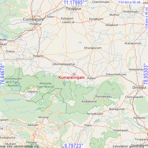
Kumaralingam GPS coordinates[2]
10° 29' 21.696" North, 77° 20' 59.64" East
| Map corner | latitude | longitude |
|---|---|---|
| Upper-left | 11.17995°, | 76.64678° |
| Center: | 10.48936°, | 77.3499° |
| Lower-right: | 9.79723°, | 78.05303° |
| Map W x H: | 153.7×153.7 km | = 95.5×95.5mi |
| max Lat: | 34.9274° ⇑95% North |
| Kumaralingam: | 10.48936° |
| min Lat: | ⇓5% South 8.09008° |
| min Long | Kumaralingam | max Long |
| 68.82655° | 77.3499° | 96.81° |
| W 41%⇐ | ⇒59% E |
Elevation
Elevation of Kumaralingam is 323 m = 1060 ft, and this is 27.4 m = 90 ft above average elevation for this country.
| Max E: |
3681 m = 12077 ft | 30.4% |
| Kumaralingam | 323 m 1060 ft | |
| Avg. | 295.6 m = 970 ft | |
Min E: |
1 m = 3 ft | 69.6% |
See also: India elevation on elevation.city.
Geographical zone
Kumaralingam is located in North Torrid zone (between Equator and Tropic of Cancer). Distance of Equator is 1166.3 km =724.7 mi to South.| Distance of | km | miles | from Kumaralingam |
|---|---|---|---|
| North Pole | 8840.8 | 5493.4 | to North |
| Arctic Circle | 6234.9 | 3874.2 | to North |
| Tropic Cancer | 1439.6 | 894.5 | to North |
| Equator | 1166.3 | 724.7 | to South |


Nearby cities:
15 places around Kumaralingam: (largest is in red/bold)
• Anamalais
46.6 km =29 mi,  282°
282°
• Ayakudi
22.5 km =14 mi,  101°
101°
• Dhali
17.8 km =11.1 mi, 277°
• Dharapuram
34.1 km =21.2 mi,  35°
35°
• Kodaikānāl
31.7 km =19.7 mi,  151°
151°
• Kīranūr
20.4 km =12.7 mi,  55°
55°
• Marayur
31.3 km =19.4 mi,  220°
220°
• Palani
19.2 km =11.9 mi, 103°
• Periyakulam
46 km =28.6 mi, 152°
• Periyanegamam
39 km =24.2 mi,  316°
316°
• Periyapatti
31.1 km =19.3 mi,  343°
343°
• Pollachi
41.8 km =26 mi,  296°
296°
• Udumalaippettai
15.7 km =9.8 mi,  314°
314°
• Valparai
47.2 km =29.3 mi,  247°
247°
• Vettaikkaranpudur
48.4 km =30.1 mi, 279°
Sources, notices
• [Note1] Compared only with cities in India existing in our database
• [Src1] Map data: © OpenStreetMap contributors (CC-BY-SA)
• [Src2] Other city data from geonames.org with taken over terms of usage.
• [Src3] Geographical zone / Annual Mean Temperature by Robert A. Rohde @ Wikipedia
