Periyanegamam geodata
Periyanegamam (Tamil Nadu) is a populated place; located in India in Asia/Kolkata (GMT+5.5) time zone. With population of 7,913 people, there are 3131 cities with bigger population in this country. Compared to other cities in India, 94.2% of cities are located further ↑North; 62% of cities are located further →East and 72.6% of cities have lower elevation than Periyanegamam. Note1


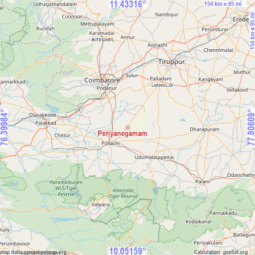
Periyanegamam GPS coordinates[2]
10° 44' 35.412" North, 77° 6' 10.656" East
| Map corner | latitude | longitude |
|---|---|---|
| Upper-left | 11.43316°, | 76.39984° |
| Center: | 10.74317°, | 77.10296° |
| Lower-right: | 10.05159°, | 77.80609° |
| Map W x H: | 153.6×153.6 km | = 95.4×95.4mi |
| max Lat: | 34.9274° ⇑94.2% North |
| Periyanegamam: | 10.74317° |
| min Lat: | ⇓5.8% South 8.09008° |
| min Long | Periyanegamam | max Long |
| 68.82655° | 77.10296° | 96.81° |
| W 38%⇐ | ⇒62% E |
Elevation
Elevation of Periyanegamam is 357 m = 1171 ft, and this is 61.4 m = 201 ft above average elevation for this country.
| Max E: |
3681 m = 12077 ft | 27.4% |
| Periyanegamam | 357 m 1171 ft | |
| Avg. | 295.6 m = 970 ft | |
Min E: |
1 m = 3 ft | 72.6% |
See also: India elevation on elevation.city.
Geographical zone
Periyanegamam is located in North Torrid zone (between Equator and Tropic of Cancer). Distance of Equator is 1194.5 km =742.2 mi to South.| Distance of | km | miles | from Periyanegamam |
|---|---|---|---|
| North Pole | 8812.5 | 5475.8 | to North |
| Arctic Circle | 6206.6 | 3856.6 | to North |
| Tropic Cancer | 1411.4 | 877 | to North |
| Equator | 1194.5 | 742.2 | to South |


Nearby cities:
15 places around Periyanegamam: (largest is in red/bold)
• Anamalais
25.6 km =15.9 mi,  225°
225°
• Chettipālaiyam
20.2 km =12.6 mi,  339°
339°
• Coimbatore
32.8 km =20.4 mi,  332°
332°
• Dhali
27.5 km =17.1 mi,  160°
160°
• Irugūr
30.9 km =19.2 mi,  351°
351°
• Kumaralingam
39 km =24.2 mi,  136°
136°
• Madukkarai
23.6 km =14.7 mi,  319°
319°
• Palladam
34.1 km =21.2 mi,  35°
35°
• Periyapatti
18.4 km =11.4 mi,  84°
84°
• Perūr
33.1 km =20.6 mi, 321°
• Pollachi
14 km =8.7 mi, 227°
• Singānallūr
29.5 km =18.3 mi, 344°
• Sulur
31.4 km =19.5 mi,  4°
4°
• Udumalaippettai
23.4 km =14.5 mi, 137°
• Vettaikkaranpudur
28.9 km =18 mi, 225°
Sources, notices
• [Note1] Compared only with cities in India existing in our database
• [Src1] Map data: © OpenStreetMap contributors (CC-BY-SA)
• [Src2] Other city data from geonames.org with taken over terms of usage.
• [Src3] Geographical zone / Annual Mean Temperature by Robert A. Rohde @ Wikipedia
