Kūkatpalli geodata
Kūkatpalli (Telangana) is a populated place; located in India in Asia/Kolkata (GMT+5.5) time zone. With population of 341,709 people, there are 124 cities with bigger population in this country. Compared to other cities in India, 73.4% of cities are located further ↑North; 53.2% of cities are located further ←West and 86.3% of cities have lower elevation than Kūkatpalli. Note1


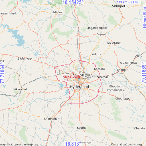
Kūkatpalli GPS coordinates[2]
17° 29' 5.496" North, 78° 24' 49.536" East
| Map corner | latitude | longitude |
|---|---|---|
| Upper-left | 18.15425°, | 77.71064° |
| Center: | 17.48486°, | 78.41376° |
| Lower-right: | 16.813°, | 79.11689° |
| Map W x H: | 149.1×149.1 km | = 92.6×92.6mi |
| max Lat: | 34.9274° ⇑73.4% North |
| Kūkatpalli: | 17.48486° |
| min Lat: | ⇓26.6% South 8.09008° |
| min Long | Kūkatpalli | max Long |
| 68.82655° | 78.41376° | 96.81° |
| W 53.2%⇐ | ⇒46.8% E |
Elevation
Elevation of Kūkatpalli is 566 m = 1857 ft, and this is 270.4 m = 887 ft above average elevation for this country.
| Max E: |
3681 m = 12077 ft | 13.7% |
| Kūkatpalli | 566 m 1857 ft | |
| Avg. | 295.6 m = 970 ft | |
Min E: |
1 m = 3 ft | 86.3% |
See also: Kūkatpalli elevation on elevation.city.
Geographical zone
Kūkatpalli is located in North Torrid zone (between Equator and Tropic of Cancer). Distance of this Northern Tropic circle is 661.8 km =411.2 mi to North.| Distance of | km | miles | from Kūkatpalli |
|---|---|---|---|
| North Pole | 8062.9 | 5010.1 | to North |
| Arctic Circle | 5457 | 3390.8 | to North |
| Tropic Cancer | 661.8 | 411.2 | to North |
| Equator | 1944.1 | 1208 | to South |


Nearby cities:
15 places around Kūkatpalli: (largest is in red/bold)
• Bālāpur
21.5 km =13.4 mi,  154°
154°
• Gaddi Annaram
17.6 km =10.9 mi,  138°
138°
• Ghatkesar
28.9 km =18 mi,  97°
97°
• Hyderabad
12.1 km =7.5 mi,  158°
158°
• Lal Bahadur Nagar
21.6 km =13.4 mi,  134°
134°
• Malkajgiri
12.6 km =7.8 mi,  109°
109°
• Medchal
17.6 km =10.9 mi,  23°
23°
• Patancheru
16.7 km =10.4 mi,  288°
288°
• Quthbullapur
5 km =3.1 mi,  69°
69°
• Sangāreddi
38 km =23.6 mi, 294°
• Secunderabad
13.8 km =8.6 mi,  81°
81°
• Serilingampalle
11.9 km =7.4 mi,  274°
274°
• Singāpur
30.6 km =19 mi, 266°
• Srīrāmnagar
29.5 km =18.3 mi,  214°
214°
• Uppal Kalan
17.7 km =11 mi,  119°
119°
Sources, notices
• [Note1] Compared only with cities in India existing in our database
• [Src1] Map data: © OpenStreetMap contributors (CC-BY-SA)
• [Src2] Other city data from geonames.org with taken over terms of usage.
• [Src3] Geographical zone / Annual Mean Temperature by Robert A. Rohde @ Wikipedia
