Kānker geodata
Kānker (Chhattisgarh) is a populated place; located in India in Asia/Kolkata (GMT+5.5) time zone. With population of 25,984 people, there are 1638 cities with bigger population in this country. Compared to other cities in India, 64.4% of cities are located further ↑North; 74.6% of cities are located further ←West and 76.2% of cities have lower elevation than Kānker. Note1


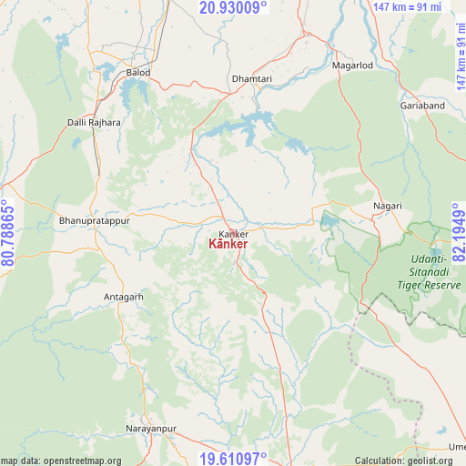
Kānker GPS coordinates[2]
20° 16' 18.948" North, 81° 29' 30.372" East
| Map corner | latitude | longitude |
|---|---|---|
| Upper-left | 20.93009°, | 80.78865° |
| Center: | 20.27193°, | 81.49177° |
| Lower-right: | 19.61097°, | 82.1949° |
| Map W x H: | 146.7×146.7 km | = 91.2×91.2mi |
| max Lat: | 34.9274° ⇑64.4% North |
| Kānker: | 20.27193° |
| min Lat: | ⇓35.6% South 8.09008° |
| min Long | Kānker | max Long |
| 68.82655° | 81.49177° | 96.81° |
| W 74.6%⇐ | ⇒25.4% E |
Elevation
Elevation of Kānker is 401 m = 1316 ft, and this is 105.4 m = 346 ft above average elevation for this country.
| Max E: |
3681 m = 12077 ft | 23.8% |
| Kānker | 401 m 1316 ft | |
| Avg. | 295.6 m = 970 ft | |
Min E: |
1 m = 3 ft | 76.2% |
See also: India elevation on elevation.city.
Geographical zone
Kānker is located in North Torrid zone (between Equator and Tropic of Cancer). Distance of this Northern Tropic circle is 351.9 km =218.7 mi to North.| Distance of | km | miles | from Kānker |
|---|---|---|---|
| North Pole | 7753 | 4817.5 | to North |
| Arctic Circle | 5147.1 | 3198.3 | to North |
| Tropic Cancer | 351.9 | 218.7 | to North |
| Equator | 2254 | 1400.6 | to South |


Nearby cities:
15 places around Kānker: (largest is in red/bold)
• Ambāgarh Chauki
95.8 km =59.5 mi,  305°
305°
• Balod
59.1 km =36.7 mi,  329°
329°
• Bhatgaon
100 km =62.1 mi,  12°
12°
• Bhilai
104.4 km =64.9 mi,  356°
356°
• Dhamtari
48.8 km =30.3 mi, 6°
• Dongargaon
102.5 km =63.7 mi,  319°
319°
• Durg
104.7 km =65.1 mi,  347°
347°
• Gariāband
71.7 km =44.6 mi,  55°
55°
• Kondagaon
77.8 km =48.3 mi,  166°
166°
• Kurud
66.6 km =41.4 mi,  21°
21°
• Narharpur
23.8 km =14.8 mi,  34°
34°
• Pātan
84.8 km =52.7 mi,  2°
2°
• Raipur
107.9 km =67 mi, 7°
• Rāj-Nāndgaon
103.6 km =64.4 mi, 332°
• Umarkot
100.6 km =62.5 mi,  132°
132°
Sources, notices
• [Note1] Compared only with cities in India existing in our database
• [Src1] Map data: © OpenStreetMap contributors (CC-BY-SA)
• [Src2] Other city data from geonames.org with taken over terms of usage.
• [Src3] Geographical zone / Annual Mean Temperature by Robert A. Rohde @ Wikipedia
