Jāmuria geodata
Jāmuria (West Bengal) is a populated place; located in India in Asia/Kolkata (GMT+5.5) time zone. With population of 160,242 people, there are 273 cities with bigger population in this country. Compared to other cities in India, 56.1% of cities are located further ↓South; 89.4% of cities are located further ←West and 63.1% of cities have higher elevation than Jāmuria. Note1


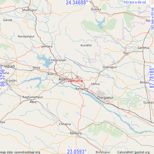
Jāmuria GPS coordinates[2]
23° 42' 16.848" North, 87° 4' 43.392" East
| Map corner | latitude | longitude |
|---|---|---|
| Upper-left | 24.34688°, | 86.3756° |
| Center: | 23.70468°, | 87.07872° |
| Lower-right: | 23.0593°, | 87.78185° |
| Map W x H: | 143.2×143.2 km | = 89×89mi |
| max Lat: | 34.9274° ⇑43.9% North |
| Jāmuria: | 23.70468° |
| min Lat: | ⇓56.1% South 8.09008° |
| min Long | Jāmuria | max Long |
| 68.82655° | 87.07872° | 96.81° |
| W 89.4%⇐ | ⇒10.6% E |
Elevation
Elevation of Jāmuria is 132 m = 433 ft, and this is 163.6 m = 537 ft below average elevation for this country.
| Max E: |
3681 m = 12077 ft | 63.1% |
| Avg. | 295.6 m = 970 ft | |
| Jāmuria | 132 m = 433 ft | |
Min E: |
1 m = 3 ft | 36.9% |
See also: Jāmuria elevation on elevation.city.
Geographical zone
Jāmuria is located in North temperate zone (between Tropic of Cancer and the Arctic Circle). Distance of this Northern Tropic circle is 29.8 km =18.5 mi to South.| Distance of | km | miles | from Jāmuria |
|---|---|---|---|
| North Pole | 7371.3 | 4580.3 | to North |
| Arctic Circle | 4765.5 | 2961.1 | to North |
| Tropic Cancer | 29.8 | 18.5 | to South |
| Equator | 2635.7 | 1637.7 | to South |


Nearby cities:
15 places around Jāmuria: (largest is in red/bold)
• Bahula
10.6 km =6.6 mi,  123°
123°
• Bakreswar
35.9 km =22.3 mi,  56°
56°
• Barjora
37.6 km =23.4 mi,  145°
145°
• Beliātor
45.1 km =28 mi,  161°
161°
• Chittaranjan
24.6 km =15.3 mi,  313°
313°
• Dubrājpur
31.8 km =19.8 mi,  72°
72°
• Durgapur
31.4 km =19.5 mi,  131°
131°
• Jāmtāra
40.2 km =25 mi,  315°
315°
• Kulti
24.1 km =15 mi,  277°
277°
• Lakhyabad
42.2 km =26.2 mi,  264°
264°
• Mugma
36.5 km =22.7 mi, 281°
• Nirsā
38.9 km =24.2 mi, 283°
• Raghunathpur
45.2 km =28.1 mi,  245°
245°
• Rānīganj
11.1 km =6.9 mi, 151°
• Āsansol
10 km =6.2 mi, 256°
Sources, notices
• [Note1] Compared only with cities in India existing in our database
• [Src1] Map data: © OpenStreetMap contributors (CC-BY-SA)
• [Src2] Other city data from geonames.org with taken over terms of usage.
• [Src3] Geographical zone / Annual Mean Temperature by Robert A. Rohde @ Wikipedia
