Jalpāiguri geodata
Jalpāiguri (West Bengal) is a seat of a second-order administrative division; located in India in Asia/Kolkata (GMT+5.5) time zone. With population of 107,832 people, there are 411 cities with bigger population in this country. Compared to other cities in India, 74.9% of cities are located further ↓South; 94.8% of cities are located further ←West and 71.2% of cities have higher elevation than Jalpāiguri. Note1


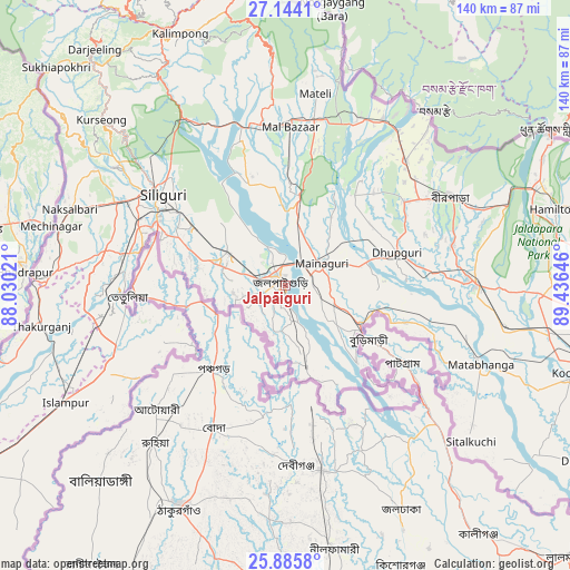
Jalpāiguri GPS coordinates[2]
26° 31' 0.012" North, 88° 43' 59.988" East
| Map corner | latitude | longitude |
|---|---|---|
| Upper-left | 27.1441°, | 88.03021° |
| Center: | 26.51667°, | 88.73333° |
| Lower-right: | 25.8858°, | 89.43646° |
| Map W x H: | 139.9×139.9 km | = 86.9×86.9mi |
| max Lat: | 34.9274° ⇑25.1% North |
| Jalpāiguri: | 26.51667° |
| min Lat: | ⇓74.9% South 8.09008° |
| min Long | Jalpāiguri | max Long |
| 68.82655° | 88.73333° | 96.81° |
| W 94.8%⇐ | ⇒5.2% E |
Elevation
Elevation of Jalpāiguri is 87 m = 285 ft, and this is 208.6 m = 684 ft below average elevation for this country.
| Max E: |
3681 m = 12077 ft | 71.2% |
| Avg. | 295.6 m = 970 ft | |
| Jalpāiguri | 87 m = 285 ft | |
Min E: |
1 m = 3 ft | 28.8% |
See also: Jalpāiguri elevation on elevation.city.
Geographical zone
Jalpāiguri is located in North temperate zone (between Tropic of Cancer and the Arctic Circle). Distance of this Northern Tropic circle is 342.5 km =212.8 mi to South.| Distance of | km | miles | from Jalpāiguri |
|---|---|---|---|
| North Pole | 7058.7 | 4386.1 | to North |
| Arctic Circle | 4452.8 | 2766.8 | to North |
| Tropic Cancer | 342.5 | 212.8 | to South |
| Equator | 2948.4 | 1832.1 | to South |


Nearby cities:
15 places around Jalpāiguri: (largest is in red/bold)
• Bagdogra
46.6 km =29 mi,  295°
295°
• Birpara
46 km =28.6 mi,  63°
63°
• Dhupgāri
28.4 km =17.6 mi,  73°
73°
• Fālākāta
46.9 km =29.1 mi,  89°
89°
• Goyerkāta
35.5 km =22.1 mi,  54°
54°
• Haldībāri
20.4 km =12.7 mi,  166°
166°
• Islāmpur
60.9 km =37.8 mi,  242°
242°
• Kalimpong, Крукети
65.8 km =40.9 mi,  335°
335°
• Kārsiyāng
60.9 km =37.8 mi,  311°
311°
• Maināguri
10.1 km =6.3 mi, 59°
• Mātābhānga
51.8 km =32.2 mi,  112°
112°
• Naksalbāri
54.3 km =33.7 mi,  289°
289°
• Odlābāri
37 km =23 mi, 343°
• Siliguri
37.2 km =23.1 mi, 305°
• Thākurganj
60.8 km =37.8 mi,  260°
260°
Sources, notices
• [Note1] Compared only with cities in India existing in our database
• [Src1] Map data: © OpenStreetMap contributors (CC-BY-SA)
• [Src2] Other city data from geonames.org with taken over terms of usage.
• [Src3] Geographical zone / Annual Mean Temperature by Robert A. Rohde @ Wikipedia
