Mātābhānga geodata
Mātābhānga (West Bengal) is a populated place; located in India in Asia/Kolkata (GMT+5.5) time zone. With population of 22,642 people, there are 1861 cities with bigger population in this country. Compared to other cities in India, 73.4% of cities are located further ↓South; 95.2% of cities are located further ←West and 77.7% of cities have higher elevation than Mātābhānga. Note1


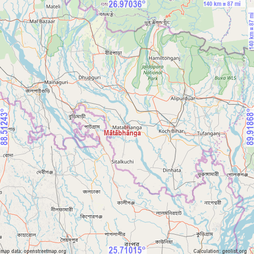
Mātābhānga GPS coordinates[2]
26° 20' 31.092" North, 89° 12' 55.98" East
| Map corner | latitude | longitude |
|---|---|---|
| Upper-left | 26.97036°, | 88.51243° |
| Center: | 26.34197°, | 89.21555° |
| Lower-right: | 25.71015°, | 89.91868° |
| Map W x H: | 140.1×140.1 km | = 87.1×87.1mi |
| max Lat: | 34.9274° ⇑26.6% North |
| Mātābhānga: | 26.34197° |
| min Lat: | ⇓73.4% South 8.09008° |
| min Long | Mātābhānga | max Long |
| 68.82655° | 89.21555° | 96.81° |
| W 95.2%⇐ | ⇒4.8% E |
Elevation
Elevation of Mātābhānga is 56 m = 184 ft, and this is 239.6 m = 786 ft below average elevation for this country.
| Max E: |
3681 m = 12077 ft | 77.7% |
| Avg. | 295.6 m = 970 ft | |
| Mātābhānga | 56 m = 184 ft | |
Min E: |
1 m = 3 ft | 22.3% |
See also: India elevation on elevation.city.
Geographical zone
Mātābhānga is located in North temperate zone (between Tropic of Cancer and the Arctic Circle). Distance of this Northern Tropic circle is 323 km =200.7 mi to South.| Distance of | km | miles | from Mātābhānga |
|---|---|---|---|
| North Pole | 7078.1 | 4398.1 | to North |
| Arctic Circle | 4472.2 | 2778.9 | to North |
| Tropic Cancer | 323 | 200.7 | to South |
| Equator | 2929 | 1820 | to South |


Nearby cities:
15 places around Mātābhānga: (largest is in red/bold)
• Alīpur Duār
34.4 km =21.4 mi,  62°
62°
• Birpara
40.9 km =25.4 mi,  350°
350°
• Dhupgāri
34.4 km =21.4 mi,  322°
322°
• Dīnhāta
33.6 km =20.9 mi,  133°
133°
• Fālākāta
19.8 km =12.3 mi,  356°
356°
• Golakganj
66.2 km =41.1 mi,  113°
113°
• Goyerkāta
44 km =27.3 mi,  334°
334°
• Haldībāri
43.2 km =26.8 mi,  269°
269°
• Hāsimāra
47.1 km =29.3 mi,  16°
16°
• Jaigaon
58.4 km =36.3 mi, 15°
• Jalpāiguri
51.8 km =32.2 mi,  292°
292°
• Koch Bihār
22.9 km =14.2 mi,  94°
94°
• Latabāri
64.1 km =39.8 mi, 93°
• Maināguri
46.4 km =28.8 mi,  301°
301°
• Tufānganj
44.9 km =27.9 mi, 93°
Sources, notices
• [Note1] Compared only with cities in India existing in our database
• [Src1] Map data: © OpenStreetMap contributors (CC-BY-SA)
• [Src2] Other city data from geonames.org with taken over terms of usage.
• [Src3] Geographical zone / Annual Mean Temperature by Robert A. Rohde @ Wikipedia
