Maināguri geodata
Maināguri (West Bengal) is a populated place; located in India in Asia/Kolkata (GMT+5.5) time zone. With population of 29,459 people, there are 1473 cities with bigger population in this country. Compared to other cities in India, 75.2% of cities are located further ↓South; 95% of cities are located further ←West and 70.8% of cities have higher elevation than Maināguri. Note1


Maināguri GPS coordinates[2]
26° 33' 45.468" North, 88° 49' 13.44" East
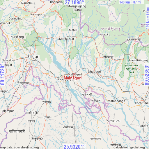
| Map corner | latitude | longitude |
|---|---|---|
| Upper-left | 27.1898°, | 88.11728° |
| Center: | 26.56263°, | 88.8204° |
| Lower-right: | 25.93201°, | 89.52353° |
| Map W x H: | 139.9×139.9 km | = 86.9×86.9mi |
| max Lat: | 34.9274° ⇑24.8% North |
| Maināguri: | 26.56263° |
| min Lat: | ⇓75.2% South 8.09008° |
| min Long | Maināguri | max Long |
| 68.82655° | 88.8204° | 96.81° |
| W 95%⇐ | ⇒5% E |
Elevation
Elevation of Maināguri is 89 m = 292 ft, and this is 206.6 m = 678 ft below average elevation for this country.
| Max E: |
3681 m = 12077 ft | 70.8% |
| Avg. | 295.6 m = 970 ft | |
| Maināguri | 89 m = 292 ft | |
Min E: |
1 m = 3 ft | 29.2% |
See also: India elevation on elevation.city.
Geographical zone
Maināguri is located in North temperate zone (between Tropic of Cancer and the Arctic Circle). Distance of this Northern Tropic circle is 347.6 km =216 mi to South.| Distance of | km | miles | from Maināguri |
|---|---|---|---|
| North Pole | 7053.6 | 4382.9 | to North |
| Arctic Circle | 4447.7 | 2763.7 | to North |
| Tropic Cancer | 347.6 | 216 | to South |
| Equator | 2953.5 | 1835.2 | to South |


Nearby cities:
15 places around Maināguri: (largest is in red/bold)
• Bagdogra
52.8 km =32.8 mi,  286°
286°
• Birpara
35.9 km =22.3 mi,  64°
64°
• Dhupgāri
18.8 km =11.7 mi,  81°
81°
• Fālākāta
38.5 km =23.9 mi,  97°
97°
• Goyerkāta
25.5 km =15.8 mi,  53°
53°
• Haldībāri
25.2 km =15.7 mi,  188°
188°
• Hāsimāra
56.8 km =35.3 mi,  68°
68°
• Jaigaon
63.6 km =39.5 mi, 60°
• Jalpāiguri
10.1 km =6.3 mi,  239°
239°
• Kalimpong, Крукети
65.4 km =40.6 mi,  327°
327°
• Kārsiyāng
64.6 km =40.1 mi,  303°
303°
• Mātābhānga
46.4 km =28.8 mi,  121°
121°
• Naksalbāri
61.2 km =38 mi,  282°
282°
• Odlābāri
35.9 km =22.3 mi, 328°
• Siliguri
42.3 km =26.3 mi, 292°
Sources, notices
• [Note1] Compared only with cities in India existing in our database
• [Src1] Map data: © OpenStreetMap contributors (CC-BY-SA)
• [Src2] Other city data from geonames.org with taken over terms of usage.
• [Src3] Geographical zone / Annual Mean Temperature by Robert A. Rohde @ Wikipedia
