Goyerkāta geodata
Goyerkāta (West Bengal) is a populated place; located in India in Asia/Kolkata (GMT+5.5) time zone. With population of 66,358 people, there are 655 cities with bigger population in this country. Compared to other cities in India, 76% of cities are located further ↓South; 95.2% of cities are located further ←West and 67.6% of cities have higher elevation than Goyerkāta. Note1


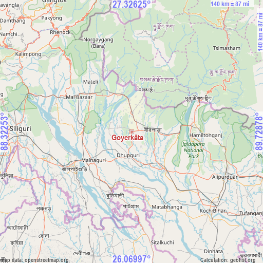
Goyerkāta GPS coordinates[2]
26° 41' 59.424" North, 89° 1' 32.34" East
| Map corner | latitude | longitude |
|---|---|---|
| Upper-left | 27.32625°, | 88.32253° |
| Center: | 26.69984°, | 89.02565° |
| Lower-right: | 26.06997°, | 89.72878° |
| Map W x H: | 139.7×139.7 km | = 86.8×86.8mi |
| max Lat: | 34.9274° ⇑24% North |
| Goyerkāta: | 26.69984° |
| min Lat: | ⇓76% South 8.09008° |
| min Long | Goyerkāta | max Long |
| 68.82655° | 89.02565° | 96.81° |
| W 95.2%⇐ | ⇒4.8% E |
Elevation
Elevation of Goyerkāta is 104 m = 341 ft, and this is 191.6 m = 629 ft below average elevation for this country.
| Max E: |
3681 m = 12077 ft | 67.6% |
| Avg. | 295.6 m = 970 ft | |
| Goyerkāta | 104 m = 341 ft | |
Min E: |
1 m = 3 ft | 32.4% |
See also: Goyerkāta elevation on elevation.city.
Geographical zone
Goyerkāta is located in North temperate zone (between Tropic of Cancer and the Arctic Circle). Distance of this Northern Tropic circle is 362.8 km =225.4 mi to South.| Distance of | km | miles | from Goyerkāta |
|---|---|---|---|
| North Pole | 7038.3 | 4373.4 | to North |
| Arctic Circle | 4432.4 | 2754.2 | to North |
| Tropic Cancer | 362.8 | 225.4 | to South |
| Equator | 2968.7 | 1844.7 | to South |


Nearby cities:
15 places around Goyerkāta: (largest is in red/bold)
• Alīpur Duār
55 km =34.2 mi,  115°
115°
• Birpara
11.9 km =7.4 mi,  87°
87°
• Dhupgāri
12.5 km =7.8 mi,  188°
188°
• Fālākāta
26.8 km =16.7 mi,  138°
138°
• Haldībāri
46.9 km =29.1 mi,  211°
211°
• Hāsimāra
33 km =20.5 mi,  80°
80°
• Jaigaon
38.4 km =23.9 mi,  64°
64°
• Jalpāiguri
35.5 km =22.1 mi,  234°
234°
• Kalimpong, Крукети
68.5 km =42.6 mi,  305°
305°
• Koch Bihār
58.9 km =36.6 mi,  134°
134°
• Kālimpong
68.4 km =42.5 mi, 307°
• Maināguri
25.5 km =15.8 mi, 233°
• Mātābhānga
44 km =27.3 mi,  154°
154°
• Odlābāri
42.2 km =26.2 mi,  291°
291°
• Siliguri
59.3 km =36.8 mi,  271°
271°
Sources, notices
• [Note1] Compared only with cities in India existing in our database
• [Src1] Map data: © OpenStreetMap contributors (CC-BY-SA)
• [Src2] Other city data from geonames.org with taken over terms of usage.
• [Src3] Geographical zone / Annual Mean Temperature by Robert A. Rohde @ Wikipedia
