Iglās geodata
Iglās (Uttar Pradesh) is a populated place; located in India in Asia/Kolkata (GMT+5.5) time zone. With population of 13,746 people, there are 2588 cities with bigger population in this country. Compared to other cities in India, 83.1% of cities are located further ↓South; 51.9% of cities are located further →East and 53.1% of cities have higher elevation than Iglās. Note1


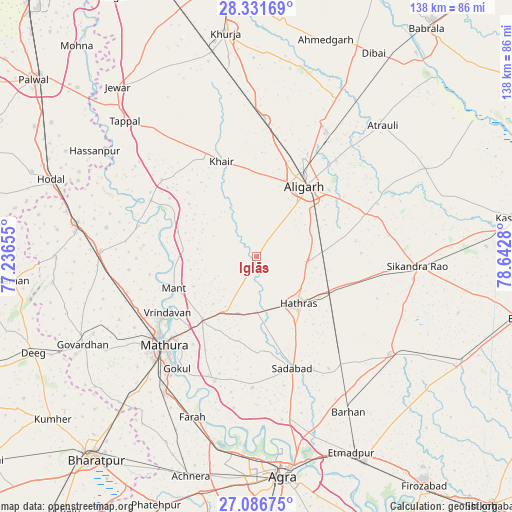
Iglās GPS coordinates[2]
27° 42' 39.6" North, 77° 56' 22.812" East
| Map corner | latitude | longitude |
|---|---|---|
| Upper-left | 28.33169°, | 77.23655° |
| Center: | 27.711°, | 77.93967° |
| Lower-right: | 27.08675°, | 78.6428° |
| Map W x H: | 138.4×138.4 km | = 86×86mi |
| max Lat: | 34.9274° ⇑16.9% North |
| Iglās: | 27.711° |
| min Lat: | ⇓83.1% South 8.09008° |
| min Long | Iglās | max Long |
| 68.82655° | 77.93967° | 96.81° |
| W 48.1%⇐ | ⇒51.9% E |
Elevation
Elevation of Iglās is 183 m = 600 ft, and this is 112.6 m = 369 ft below average elevation for this country.
| Max E: |
3681 m = 12077 ft | 53.1% |
| Avg. | 295.6 m = 970 ft | |
| Iglās | 183 m = 600 ft | |
Min E: |
1 m = 3 ft | 46.9% |
See also: India elevation on elevation.city.
Geographical zone
Iglās is located in North temperate zone (between Tropic of Cancer and the Arctic Circle). Distance of this Northern Tropic circle is 475.3 km =295.3 mi to South.| Distance of | km | miles | from Iglās |
|---|---|---|---|
| North Pole | 6925.9 | 4303.6 | to North |
| Arctic Circle | 4320 | 2684.3 | to North |
| Tropic Cancer | 475.3 | 295.3 | to South |
| Equator | 3081.2 | 1914.6 | to South |


Nearby cities:
15 places around Iglās: (largest is in red/bold)
• Alīgarh
23.1 km =14.4 mi,  35°
35°
• Baldev
35.7 km =22.2 mi,  198°
198°
• Beswān
10 km =6.2 mi,  215°
215°
• Bājna
33.1 km =20.6 mi,  308°
308°
• Harduāganj
33.6 km =20.9 mi, 39°
• Hāthras
17 km =10.6 mi,  139°
139°
• Jalālī
35.3 km =21.9 mi,  60°
60°
• Khair
27.4 km =17 mi,  339°
339°
• Mahāban
36.5 km =22.7 mi,  212°
212°
• Mathura
35 km =21.7 mi,  228°
228°
• Mursān
14.8 km =9.2 mi,  179°
179°
• Rāya
22.7 km =14.1 mi, 220°
• Sadābād
31.8 km =19.8 mi,  162°
162°
• Sāsni
14.1 km =8.8 mi,  93°
93°
• Vrindāvan
28 km =17.4 mi,  238°
238°
Sources, notices
• [Note1] Compared only with cities in India existing in our database
• [Src1] Map data: © OpenStreetMap contributors (CC-BY-SA)
• [Src2] Other city data from geonames.org with taken over terms of usage.
• [Src3] Geographical zone / Annual Mean Temperature by Robert A. Rohde @ Wikipedia
