Gannavaram geodata
Gannavaram (Andhra Pradesh) is a populated place; located in India in Asia/Kolkata (GMT+5.5) time zone. With population of 19,410 people, there are 2081 cities with bigger population in this country. Compared to other cities in India, 76.2% of cities are located further ↑North; 72.2% of cities are located further ←West and 85.5% of cities have higher elevation than Gannavaram. Note1


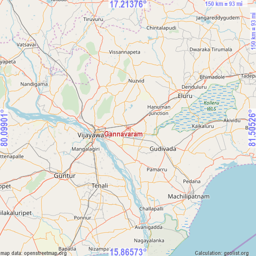
Gannavaram GPS coordinates[2]
16° 32' 27.312" North, 80° 48' 7.668" East
| Map corner | latitude | longitude |
|---|---|---|
| Upper-left | 17.21376°, | 80.09901° |
| Center: | 16.54092°, | 80.80213° |
| Lower-right: | 15.86573°, | 81.50526° |
| Map W x H: | 149.9×149.9 km | = 93.1×93.1mi |
| max Lat: | 34.9274° ⇑76.2% North |
| Gannavaram: | 16.54092° |
| min Lat: | ⇓23.8% South 8.09008° |
| min Long | Gannavaram | max Long |
| 68.82655° | 80.80213° | 96.81° |
| W 72.2%⇐ | ⇒27.8% E |
Elevation
Elevation of Gannavaram is 29 m = 95 ft, and this is 266.6 m = 875 ft below average elevation for this country.
| Max E: |
3681 m = 12077 ft | 85.5% |
| Avg. | 295.6 m = 970 ft | |
| Gannavaram | 29 m = 95 ft | |
Min E: |
1 m = 3 ft | 14.5% |
See also: India elevation on elevation.city.
Geographical zone
Gannavaram is located in North Torrid zone (between Equator and Tropic of Cancer). Distance of this Northern Tropic circle is 766.7 km =476.4 mi to North.| Distance of | km | miles | from Gannavaram |
|---|---|---|---|
| North Pole | 8167.9 | 5075.3 | to North |
| Arctic Circle | 5562 | 3456.1 | to North |
| Tropic Cancer | 766.7 | 476.4 | to North |
| Equator | 1839.2 | 1142.8 | to South |


Nearby cities:
15 places around Gannavaram: (largest is in red/bold)
• Ellore
37.5 km =23.3 mi,  59°
59°
• Gudivāda
23.7 km =14.7 mi,  119°
119°
• Gudlavalleru
33.9 km =21.1 mi,  128°
128°
• Guntur
45.5 km =28.3 mi,  233°
233°
• Kaikalūr
43.9 km =27.3 mi,  88°
88°
• Kankipādu
12.3 km =7.6 mi,  197°
197°
• Kolanukonda
22.6 km =14 mi,  244°
244°
• Kondapalle
29 km =18 mi,  287°
287°
• Korukollu
48 km =29.8 mi,  95°
95°
• Mangalagiri
27.8 km =17.3 mi, 243°
• Nūzvīd
27.9 km =17.3 mi,  9°
9°
• Tādepalle
22.5 km =14 mi,  253°
253°
• Vijayawada
17 km =10.6 mi,  257°
257°
• Vuyyūru
20.3 km =12.6 mi,  167°
167°
• Yanamalakuduru
15.6 km =9.7 mi, 246°
Sources, notices
• [Note1] Compared only with cities in India existing in our database
• [Src1] Map data: © OpenStreetMap contributors (CC-BY-SA)
• [Src2] Other city data from geonames.org with taken over terms of usage.
• [Src3] Geographical zone / Annual Mean Temperature by Robert A. Rohde @ Wikipedia
