Fatehpur Sīkri geodata
Fatehpur Sīkri (Uttar Pradesh) is a populated place; located in India in Asia/Kolkata (GMT+5.5) time zone. With population of 30,026 people, there are 1441 cities with bigger population in this country. Compared to other cities in India, 79.1% of cities are located further ↓South; 55.4% of cities are located further →East and 51.9% of cities have lower elevation than Fatehpur Sīkri. Note1


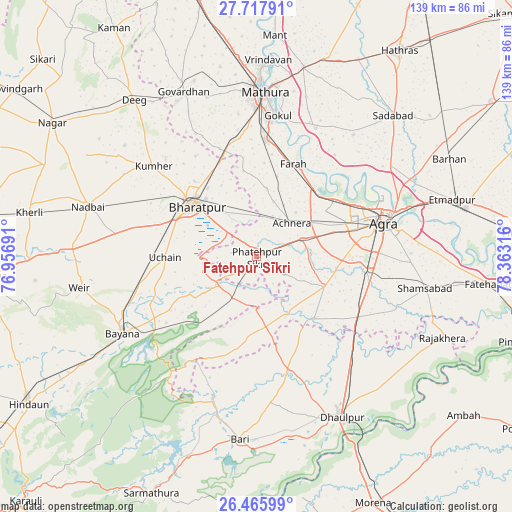
Fatehpur Sīkri GPS coordinates[2]
27° 5' 37.32" North, 77° 39' 36.108" East
| Map corner | latitude | longitude |
|---|---|---|
| Upper-left | 27.71791°, | 76.95691° |
| Center: | 27.0937°, | 77.66003° |
| Lower-right: | 26.46599°, | 78.36316° |
| Map W x H: | 139.2×139.2 km | = 86.5×86.5mi |
| max Lat: | 34.9274° ⇑20.9% North |
| Fatehpur Sīkri: | 27.0937° |
| min Lat: | ⇓79.1% South 8.09008° |
| min Long | Fatehpur Sīkri | max Long |
| 68.82655° | 77.66003° | 96.81° |
| W 44.6%⇐ | ⇒55.4% E |
Elevation
Elevation of Fatehpur Sīkri is 213 m = 699 ft, and this is 82.6 m = 271 ft below average elevation for this country.
| Max E: |
3681 m = 12077 ft | 48.1% |
| Avg. | 295.6 m = 970 ft | |
| Fatehpur Sīkri | 213 m = 699 ft | |
Min E: |
1 m = 3 ft | 51.9% |
See also: India elevation on elevation.city.
Geographical zone
Fatehpur Sīkri is located in North temperate zone (between Tropic of Cancer and the Arctic Circle). Distance of this Northern Tropic circle is 406.6 km =252.6 mi to South.| Distance of | km | miles | from Fatehpur Sīkri |
|---|---|---|---|
| North Pole | 6994.5 | 4346.2 | to North |
| Arctic Circle | 4388.6 | 2726.9 | to North |
| Tropic Cancer | 406.6 | 252.6 | to South |
| Equator | 3012.5 | 1871.9 | to South |


Nearby cities:
15 places around Fatehpur Sīkri: (largest is in red/bold)
• Achhnera
13.4 km =8.3 mi,  45°
45°
• Agra
36.7 km =22.8 mi,  74°
74°
• Baldev
38.3 km =23.8 mi,  24°
24°
• Bayāna
42.1 km =26.2 mi,  240°
240°
• Bharatpur
21.7 km =13.5 mi,  309°
309°
• Dayāl Bāgh
37.5 km =23.3 mi, 67°
• Farah
27.2 km =16.9 mi, 21°
• Gokul
38.9 km =24.2 mi,  8°
8°
• Jagnair
26.2 km =16.3 mi,  192°
192°
• Khairāgarh
23 km =14.3 mi,  136°
136°
• Kiraoli
13.3 km =8.3 mi, 68°
• Kūmher
37.8 km =23.5 mi, 310°
• Mahāban
38.6 km =24 mi, 12°
• Mathura
45.6 km =28.3 mi,  1°
1°
• Shamsābād
46.7 km =29 mi,  100°
100°
Sources, notices
• [Note1] Compared only with cities in India existing in our database
• [Src1] Map data: © OpenStreetMap contributors (CC-BY-SA)
• [Src2] Other city data from geonames.org with taken over terms of usage.
• [Src3] Geographical zone / Annual Mean Temperature by Robert A. Rohde @ Wikipedia
