Dhāmpur geodata
Dhāmpur (Uttar Pradesh) is a populated place; located in India in Asia/Kolkata (GMT+5.5) time zone. With population of 49,973 people, there are 890 cities with bigger population in this country. Compared to other cities in India, 90.2% of cities are located further ↓South; 54.2% of cities are located further ←West and 58.3% of cities have lower elevation than Dhāmpur. Note1


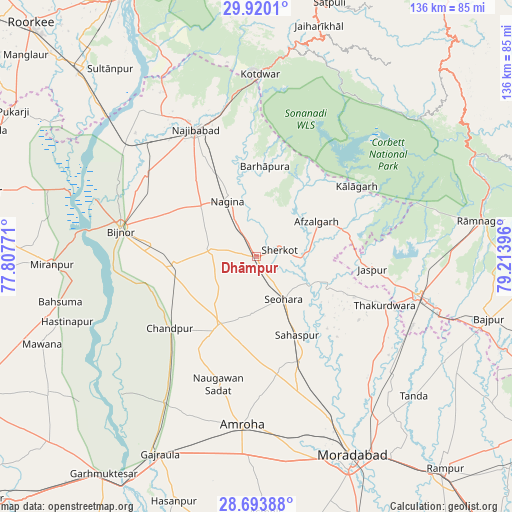
Dhāmpur GPS coordinates[2]
29° 18' 31.788" North, 78° 30' 38.988" East
| Map corner | latitude | longitude |
|---|---|---|
| Upper-left | 29.9201°, | 77.80771° |
| Center: | 29.30883°, | 78.51083° |
| Lower-right: | 28.69388°, | 79.21396° |
| Map W x H: | 136.3×136.3 km | = 84.7×84.7mi |
| max Lat: | 34.9274° ⇑9.8% North |
| Dhāmpur: | 29.30883° |
| min Lat: | ⇓90.2% South 8.09008° |
| min Long | Dhāmpur | max Long |
| 68.82655° | 78.51083° | 96.81° |
| W 54.2%⇐ | ⇒45.8% E |
Elevation
Elevation of Dhāmpur is 241 m = 791 ft, and this is 54.6 m = 179 ft below average elevation for this country.
| Max E: |
3681 m = 12077 ft | 41.7% |
| Avg. | 295.6 m = 970 ft | |
| Dhāmpur | 241 m = 791 ft | |
Min E: |
1 m = 3 ft | 58.3% |
See also: Dhāmpur elevation on elevation.city.
Geographical zone
Dhāmpur is located in North temperate zone (between Tropic of Cancer and the Arctic Circle). Distance of this Northern Tropic circle is 652.9 km =405.7 mi to South.| Distance of | km | miles | from Dhāmpur |
|---|---|---|---|
| North Pole | 6748.2 | 4193.1 | to North |
| Arctic Circle | 4142.3 | 2573.9 | to North |
| Tropic Cancer | 652.9 | 405.7 | to South |
| Equator | 3258.8 | 2024.9 | to South |


Nearby cities:
15 places around Dhāmpur: (largest is in red/bold)
• Afzalgarh
18.4 km =11.4 mi,  59°
59°
• Chāndpur
30.2 km =18.8 mi,  230°
230°
• Haldaur
22.1 km =13.7 mi,  264°
264°
• Jaspur
30.9 km =19.2 mi,  96°
96°
• Jhālu
27.8 km =17.3 mi,  276°
276°
• Kālāgarh Project Colony
32.5 km =20.2 mi,  54°
54°
• Kānth
30 km =18.6 mi,  157°
157°
• Nagīna
16.7 km =10.4 mi,  334°
334°
• Nihtaur
12.1 km =7.5 mi, 278°
• Nūrpur
20.3 km =12.6 mi,  209°
209°
• Sahaspur
23.5 km =14.6 mi,  152°
152°
• Seohāra
13.4 km =8.3 mi, 145°
• Sherkot
6.5 km =4 mi,  71°
71°
• Thakurdwara
36.4 km =22.6 mi,  110°
110°
• Tājpur
16.5 km =10.3 mi,  188°
188°
Sources, notices
• [Note1] Compared only with cities in India existing in our database
• [Src1] Map data: © OpenStreetMap contributors (CC-BY-SA)
• [Src2] Other city data from geonames.org with taken over terms of usage.
• [Src3] Geographical zone / Annual Mean Temperature by Robert A. Rohde @ Wikipedia
